SAFETY NOTE: We recommend this as a summer drive, or if driven during winter use only during lengthy periods without storms, with a 4×4 vehicle with studded snow tires and available tire chains. It won’t save you much time in winter, if any, as the driving can be quite slow. Sections have no cell phone service.
We’ve driven this route both ways quite a few times over the years. It is sublime, perhaps one of the best secondary road trips in Colorado. Have a full tank of gas, reliable vehicle, food/water, sleeping bags, that sort of gear.
Like John writes below, lots of wildlife: hawks, deer, antelope and more. Bring your binoculars and keep your speed to sub cosmic levels to avoid “harvesting” those pretty animals. Shocks and tires for dirt road “pre running” make the 20 mile gravel section more fun. Sections may be closed or receive delayed maintenance during winter storms, so skip this route if weather’s rough (or go for it if you’ve got a winch, tent, and lots of time). A big bumper to bounce deer off of helps as well.
With good conditions this drive knocks about 45 minutes off the trip between I-70 and I-80 for travel between Western Slope Colorado and places such as Jackson Wyoming or northeast Utah (though for Park City you’ll want to drive through Rangley Colorado on a more western oriented route).
In poor conditions (heavy rain or winter storms) the route will save you zero time and may even take longer.
Note that as of 2011 neither MapQuest nor Google would provide directions for connecting between north of Rock Springs Wyoming to HWY 430 in any useful way. My Tomtom automobile GPS actually did find the route, once I made the destinations close enough together to force it, as well as clicking through the “dirt roads on this route you might die” disclaimer. Otherwise, my GPS kept wanting to loop me around on the slower drive the HWY 430 route described here is used to avoid (using this route saves 45 minutes to an hour, depending on your driving style).
I brought this route up a while back in a blog post and WildSnow reader John Morrone kindly sent me an email with the following directions, he said he’s been driving these roads for twenty years. I’ll blog his info so it’s archived here for reference. Thanks John!
(Following describes route from south to north, by John, edited by Lou) From the Dinosaur-Meeker Colorado highway (CO Hwy 64) intersection on the Rifle-Meeker highway (CO Hwy 13) 2 miles west of “downtown” Meeker, go west about 1.1 miles and look for the paved Rio Blanco County Road 7 going north (“Strawberry Road”). Drive Road 7 about 39 miles north, up a broad valley and over a short steep hill (Moffat county line – now Mo. Co. Hwy 57) to US 40, near the Yampa River bridge – (this is a great out and back road bike ride from either Meeker or Maybell).
Take US 40 about 2.2 miles west, past “downtown” Maybell (don’t blink or you’ll miss it – last gas for 100 miles) and turn north on the “Ladore-Sunbeam” paved road (CO HWY 318) just before the obvious big uphill grade on 40.
Curvy up-and-down HWY 318 goes NW, crosses the Yampa River and heads across some of the most open, wildlife-rich areas of Colorado, to a split just north of the falls of Vermillion Creek at about 42 miles from Maybell.

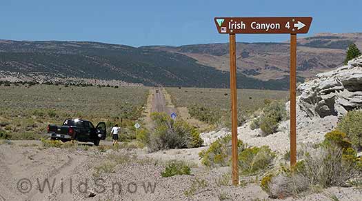
At about 42 miles from Maybell, look carefully for a dirt road (10N) splitting right. This is the Irish Canyon Road you want to be on. Beware soft shoulders. We pulled off for a break and without 4-wheel-drive would have had to call the tow truck -- only we didn't have any cell phone signal here.
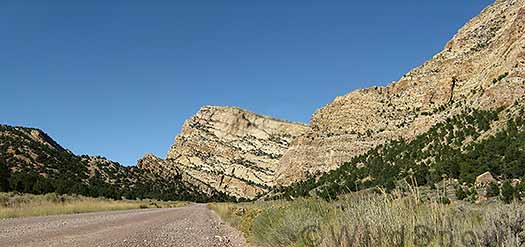
At the split leave HWY 318 and turn north on county gravel road 10N, which soon leads to the entrance of Irish Canyon. Pitstop for a look at petroglyphs when you see BLM signs for such, then continue on 10N as it climbs about 10 miles through the dry, 1500′ deep, Irish Canyon, then up over another 10 miles of rolling plateaus to the Wyoming border, where the road becomes pavement and the name changes to Wyoming 430 (total of 21.6 miles from HWY 318). Vermillion creek cut Irish Canyon, then it was abandoned as headward erosion captured the creek upstream (north) on the east side of this uplift.

Irish Canyon, Colorado. Trivia: It's said that in 1889 outlaw Butch Cassidy and the Wild Bunch hid about $20,000 in silver coins somewhere in the canyon. Stop for a few hours and search for buried treasure!
Continuing about 45 miles northerly on paved Wyo state Hwy 430 brings you into Rock Springs at its SE corner, past a big potash plant and south of Interstate 80. If you’re planning on returning the same way, commit the route through Rock Springs to memory as it is difficult to describe.
Routes through Rock Springs are confusing due to belt routes and bypasses, not to mention boomtown traffic and constant road construction. As you enter Rock Springs near the end of HWY 430 you drive next to a mobile home park and onto a new (circa 2008) South Side Belt Loop “bypass” highway that you can drive west to the west Rock Springs I-80 bypass area, or east to the east Rock Springs intersection with I-80. For example, if you’re looking for HWY 191 to Jackson Wyoming, take a right on the South Side Belt Loop and drive easterly to I-80, then drive west on I-80 for about 2 miles to exit north onto 191.
This is a truly nice variation and slightly quicker than the interstate-state highway boredom. Though not recommended in storms (winter or summer) or after dark (LOTS of wildlife, no shoulders, twisty).
Updated by Lou, October 2011: If you’re coming from north to south, the trick when you reach Rock Springs is to remember that you’re looking for HWY 30 and 430. The easiest way to find your roads is first get on either of several “belt loops” through Rock Springs, which are relatively well signed.
If you’re on HWY 191 from Pinedale or Jackson Hole Wyoming, go EAST when you T into Interstate 80, drive about 2 miles on I80 and take Exit 107 (sign may indicate Pilot Butte Avenue). You’ll do a funny loop that first heads east then curves around westerly. Take a right on US30 and continue a short distance to a stoplight 4-way intersection. Take a left at the stoplight and you’ll be on the Southside Belt Loop (HWY 376). Stay on the Belt Loop a few miles to New Hampshire Street, where you’ll take a left to what quickly becomes HWY 430. Signs do indicate 430, but may not be highly visible at night.
If you’re coming from the west on I-80, simplest is to stay on I-80 to Exit 107 as mentioned above, but if you end up taking the business loop from the west, do this: Drive the business loop and turn right on a poorly signed stoplight intersection just east of the Albertsons store and next to signs for Autozone and JB’s. Signs indicate this intersection is for 376/430, but they go by fast in the boomtown traffic. Once you’re on HWY 376, it loops around 2.4 miles in confusing fashion to a well signed turn on to HWY 430 which begins as New Hampshire Street.
Whatever the case, once you’re on 430 breath a sigh of relief and head southerly for Irish Canyon and beyond, as described by reversing the directions above. During one trip a few years ago I drove the Rock Springs to I-70 section at night — it was a deer nightmare. Even with four flame thrower auxiliary driving lights and a big aftermarket bumper, the hundreds of bambis prancing on and next to the road made me feel like I was in some sort of perverse video game (read: deer guts). As mentioned above, not recommended for night driving, and keep your speed down even during the day.
Times: It takes about four hours to drive from Rifle, Colorado to Rock springs via this route. The drive between Jackson Hole and Aspen area usually takes us about 8 hours, including a few stops. We’ve made it in 7 hours on a good day with less stopping.

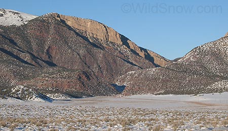
Irish Canyon entrance from south, during winter.
WildSnow.com publisher emeritus and founder Lou (Louis Dawson) has a 50+ years career in climbing, backcountry skiing and ski mountaineering. He was the first person in history to ski down all 54 Colorado 14,000-foot peaks, has authored numerous books about about backcountry skiing, and has skied from the summit of Denali in Alaska, North America’s highest mountain.
