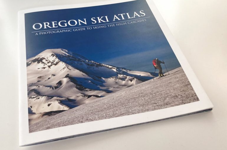
At first glance, the recently released Oregon Ski Atlas: A Photographic Guide to Skiing The High Cascades seems to miss the mark. And specifically, miss the mark for me. I had seen the blitz of pre-release Instagram posts about the book. There appeared to be hype. I suppose what I was expecting was a full-blown fleshed-out version of ski atlas I have seen from Beacon Books: Those spiral-bound beauties include detailed maps, photos, and data like max slope angles, ATES ratings (avalanche terrain rating), and ski runs listed out.
These guide books have set a high bar. And I can imagine, for some, they have opened the gates to coveted ski terrain, and surf-spot territorialism and resentment may have followed. But that’s a different story.
Oregon is not overburdened with ski guides. Of course, there’s the Internet and that goldmine-to-minefield source of information. Have at it.
OREGON HIGH: A Climbing Guide to Nine Cascade Volcanoes, published in 1991, remains a reliable source of climbing information if you can find the book. The guide is geared towards climbers, mountaineers, alpinists. Yet, as skills have evolved, many of these ascent routes are now prized ski descents. There is also the 2011 guide, Backcountry Ski & Snowboard Routes Oregon, by Chris Van Tilburg. This guide is comprehensive in scope and includes beta on the region’s volcanoes and below treeline skiing and lines on the plentiful mountains peppering the state.
So, where does the Oregon Ski Atlas fit on the bookshelf, or as the author claims, the coffee table?
Here’s what the Oregon Ski Atlas is not: a full-blown here’s how to access, ascend, and ski lines in the Oregon High Cascades. Initially, I wanted more. Or, expected more. I think the reason for those expectations is that guidebooks often become encyclopedic. Having access to that information – the who, what, why, and where – all at my fingertips can be reassuring.

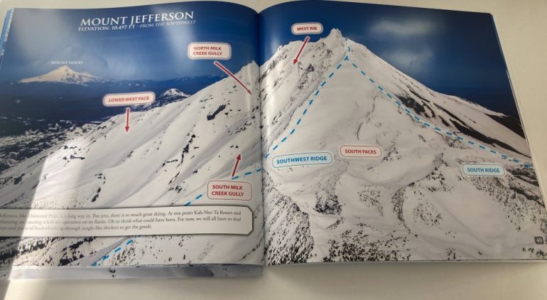
A typical image from the Oregon Ski Atlas: just the basics.
On the flip side, a shortage of information has its place too. Still, the Oregon Ski Atlas is not a guidebook in a traditional sense. It leaves plenty of mystery and adventure available to those willing to look at an image with a few lines and labels inserted and have a go at it. You’ll have to find access information, the best time to go, slope angles, etc., elsewhere or in the field.
“Part of the experience of backcountry skiing is exploration, and in that spirit, this book shows you what is possible, but it’s up to you to figure out the details,” states the book’s website. That’s true. There are 48 pages of photographs, but, again, you’ll be required to infill much of the required information to pull off a successful ski.
I’ve come around to this slim volume’s beauty. The photos are crisp and broad enough to get a wide-angle view of the landscape and terrain. Some peaks, like Mount Washington, receive a three-page treatment, while more accessed and explored terrain, like Broken Top, spawn a six-page spread.

A photograph and info for an aspect of the North Sister.
Here in Oregon, we often avoid the dreaded persistent weak layers that afflict much of the West. We are lucky. We are also currently experiencing a significant high-pressure cycle. Now, some higher altitude, more exposed alpine terrain is skiable. A few north-facing lines still hold soft snow. (But that window may have passed.)
At the dinner table recently, the oldest child home on winter break, and his pal from Bozeman, were sifting through the Oregon Ski Atlas. They picked a plum line on the North Sister for Friday’s outing and another north-facing shot off Broken Top for Saturday’s excursion. Their eyes were glued to the book’s photographs, all while discussing a basic ski day plan. The friend from Bozeman (Sawyer) could get a clear sense of the ski mission and a basic idea of the terrain with the Oregon Ski Atlas as his guide. In a new zone, there’s always something reassuring about that; just getting a lay of the land before you start the ascent. The Oregon Ski Atlas provides that in spades.

An image of Broken Top from the Oregon Ski Atlas with just enough information to get you started.
Hearing this dialogue between the two college freshmen about where and what to ski made me realize the value of the Oregon Ski Atlas. The book will hold your hand gently, maybe by a finger, but it’s not going to take you there and get you back. In this case, that’s a good thing.
My biggest concern with the guide is that I want it to last. In its current form, it seems a bit delicate. The book’s binding consists of two hardy staples (and maybe some glue?). Not very robust. This title will set you back $35.00.
The Oregon Ski Atlas includes information on:
Mount Mcloughlin, Mount Thielsen, Diamond Peak, Broken Top, South Sister, Middle Sister, North Sister, Mount Washington, Three Fingered Jack, Mount Jefferson, and Mount Hood.
Dexter Burke is the author, and the publisher is Alpenglow Publishing Studio.
Buy the Oregon Ski Atlas.
Jason Albert comes to WildSnow from Bend, Oregon. After growing up on the East Coast, he migrated from Montana to Colorado and settled in Oregon. Simple pleasures are quiet and long days touring. His gray hair might stem from his first Grand Traverse in 2000 when rented leather boots and 210cm skis were not the speed weapons he had hoped for. Jason survived the transition from free-heel kool-aid drinker to faster and lighter (think AT), and safer, are better.
