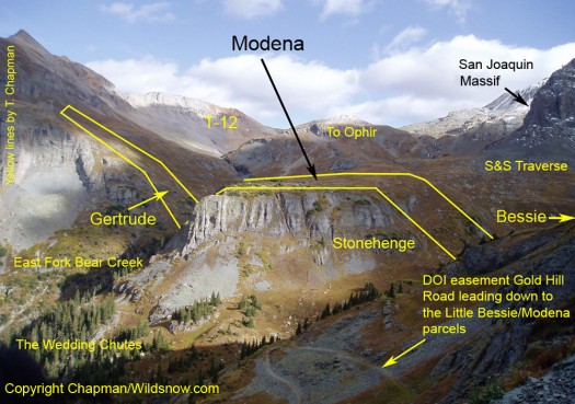
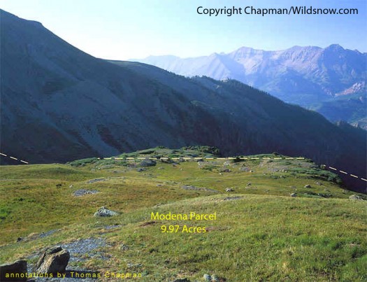
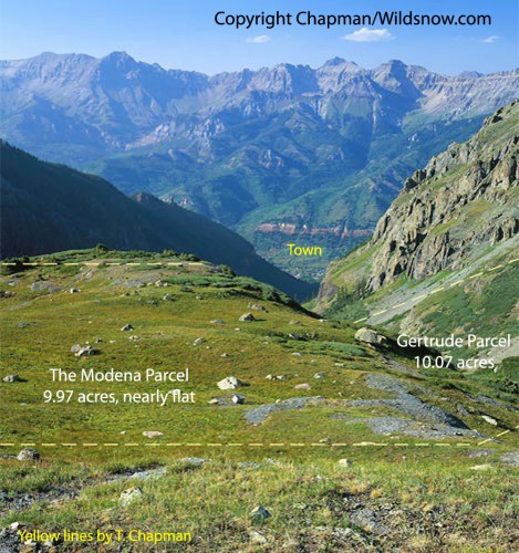
When you want to get past private property during recreation access to public land, the first thing you look for are gaps where property parcels don’t touch. Walk or ski through there, and all is good. You’re not trespassing, everyone is happy. Or at least, we hope everyone is happy; which wasn’t the case with the couple having a go in their glass house up by Aspen after we hiked by in the dark (until the security lights blasted on) going elk hunting through a “gap” we’d found on a map that got us past their property. But that’s another story…
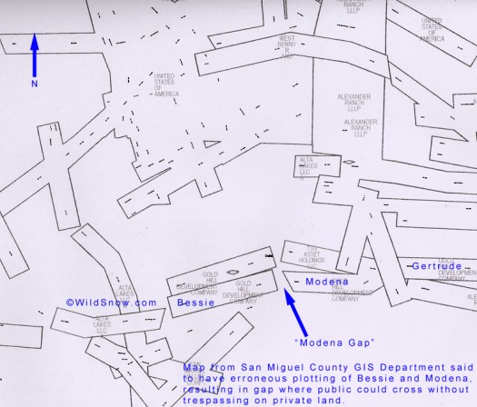
San Miguel County mapping showing supposed 'Modena Gap' (my term) that would provide easy movement through the Gold Hill Development parcels in Upper Bear Creek above Telluride, Colorado. Click image to enlarge.
Recently, journalists and interested citizens noticed that when the southern Colorado San Miguel County GIS department mapped the controversial Gold Hill Development (Thomas Chapman and associates) Bessie and Modena mining claims in Bear Basin, they showed a good sized gap between the two claims.
According to this Dec. 9 article in the Telluride Daily News:
“According to a map provided by the company, the mining claims form a solid wall stretching up the sides of the valley…But anyone who looks on the county’s property website can see it tells a different story… In the county’s records, the mining claims are not contiguous. There is a gap between the claims…”
The above referenced report and probably others began what could become an interesting mini-controversy within the greater issue of Gold Hill Development and other private property in Bear Creek, next to Telluride Resort in southwestern Colorado.
Thus, while not as easy as having free run of the basin, it appeared everyone could be happy about skiing upper Bear Basin and getting through the GHD land. Sadly, a high quality certified survey done by registered surveyor Robert A. Larson shows there is no gap. To the best of my knowledge, a certified survey trumps more general and error prone County mapping, which always includes a disclaimer about its accuracy and says “…the data are not a substitute…for a survey.” It’ll be interesting to see where this goes. To court? Or will San Miguel GIS re-check their cords and make a public statement? And how about the elected County Surveyor, who perhaps is the guy to speak up and clarify and hopefully accurize the situation?
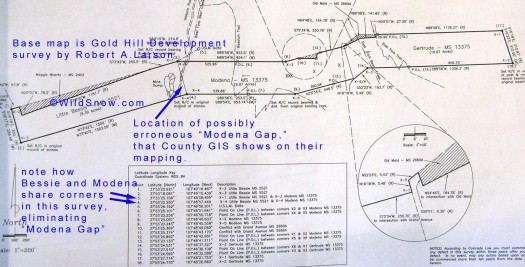
Robert Larson survey, showing union of Bessie and Modena, no gap. I know a bit about the process of surveying these parcels, and the surveyor goes to quite a bit of trouble making sure their coordinates are correct, and that they work from reliable monuments on the ground. If Larson determined that the corners of Bessie and Modena are shared, it would seem unlikely that would not be so. But mistakes do happen so we'll see what San Miguel County does to shed light on this situation. Seems like that would be a job for the County Surveyor, but as Thomas Chapman commented about on another blog post, not much has happened in that area so far. The Surveyor is elected, and perhaps he's a backcountry skier? Modena Gap, here we come!? Click image to enlarge.
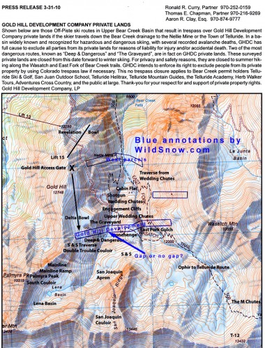
Gold Hill Development press release text and map, with annotations by WildSnow.com. Note how the West parcels lower down to the north (Laura and Nellie claims) also block the logical route in and out of Bear Creek. It's possible that savvy backcountry skiers could traverse around the west end of the Nellie by using a lower angled terrain feature called 'Nellie Bench,' but as I'm not familiar with the area (I skied the Ophir/Telluride route many years ago, so memory fails), I'm not sure what would work. Others say it might be possible to get around the east end of the West parcels. I've got some inquires out there, and perhaps some of you commenters can chime in on that. Also, according to Telluride sources, around 75 percent of Bear Basin skiers drop in before hitting the Gold Hill property, eventually heading down what the photo below labels as E-ticket. If those skiers had a way to return to the resort or exit Bear Creek without crossing private land, that would take care of a huge chunk of this issue. Click image to enlarge.
Several photos removed in this section, by request of the photographer.
So, for all you WildSnowers curious about one of the issues that’s come up with the Gold Hill Development property adjacent to Telluride Resort, that’s the “Modena Gap” controversy in a rather large nutshell. (new content, 12/19/2010a) Below, we publish some of Chapman’s photos that show the GHD property from different perspectives.
WildSnow.com publisher emeritus and founder Lou (Louis Dawson) has a 50+ years career in climbing, backcountry skiing and ski mountaineering. He was the first person in history to ski down all 54 Colorado 14,000-foot peaks, has authored numerous books about about backcountry skiing, and has skied from the summit of Denali in Alaska, North America’s highest mountain.

