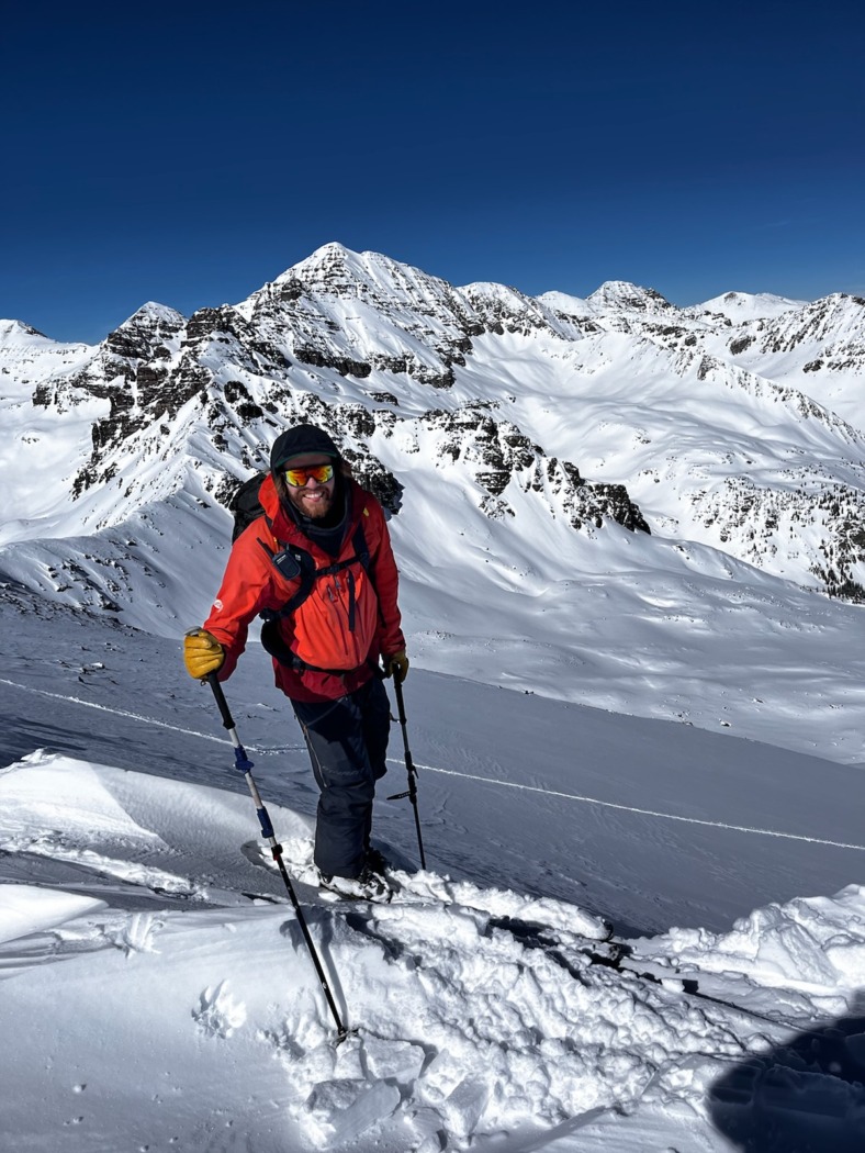
Dylan Craaybeek is a backcountry skier and avalanche forecaster for the Colorado Avalanche Information Center based in the Crystal Valley near Carbondale. He generates the avalanche forecast for the Central Mountains, which include the Grand Mesa, the West Elk and Elk Mountains, the Hunter-Fryingpan Wilderness, and the Sawatch Range.

Last summer, he also worked as a highway avalanche forecaster in New Zealand on the Milford Road. Before joining the CAIC, Craaybeek worked as a tail guide for splitboarding and skiing, avalanche instructor, and snow hydrologist (mainly working on the NASA SnowEx campaign). And like many snow-lovers, he also spent time as a liftie for Vail Mountain.
This Q&A is the first of a series of interviews with avalanche forecasters. Have questions you’ve always wanted to ask a forecaster? Post them in the comments and we’ll pose them to forecasters in future installments.
WS: What made you interested enough in snow science to pursue it as a career?
DC: When I first moved to Colorado, I studied physics and astrophysics at the University of Colorado for a few semesters before dropping out for financial reasons. That’s when I moved to Vail to be a liftie and fell in love with backcountry touring. I had a few close calls with avalanches and wanted to get educated on avalanche safety so I could safely spend time in the snow-covered mountains. After taking all the recreational classes I could find, I enrolled in the Avalanche Science Program at Colorado Mountain College. This is where I first realized I could combine my love for environmental sciences and traveling in the winter backcountry environment. I finished the Avalanche Science Program and my bachelor’s degree in environmental science and spent every possible day for several years in the backcountry digging pits and learning about the snow. I fell more in love with snow with every storm, every season, and every grain of snow I looked at–especially when looking at them under a microscope. It’s hard to give an exact reason why I became so interested in snow. It could be because it allows for such efficient travel through the mountains. It could be because of the temporary nature of a seasonal snowpack. It could be because of how important and underappreciated seasonal snow cover is for the Earth’s energy budget. It could be because of how beautiful every individual grain of snow is. But mostly, I think it is because the more I learn about snow, the more I realize how much I don’t know and still need to learn.

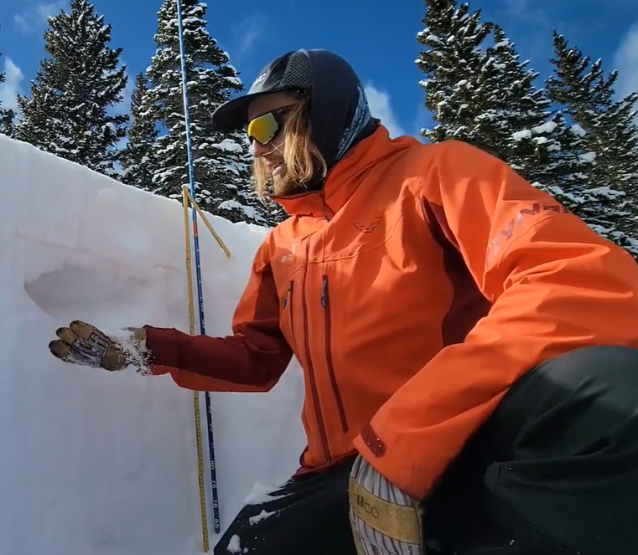
CAIC’s Dylan Craaybeek in the field collecting firsthand observations.
WS: Describe the process of creating your daily forecasts. What different kinds of information go into it and how does it all come together into what the public sees?
DC: The process of creating a daily forecast, in its essence, is analyzing the current snowpack conditions, forecasting incoming weather, and then predicting how the forecast weather will impact the snowpack. This process starts with the first snowfall of the season and often doesn’t end until the snow is melted–well into the spring or summer. I like to look at it as building a mental model of the snowpack–of what a snow profile would look like on any aspect at any given elevation in the regions where I forecast. The most useful information for my mental model comes from my fieldwork but every detail I can get my hands on is useful. This can be weather station information; remote snow sensing techniques and snowpack modeling software; discussions with backcountry users, guides, patrollers, highway workers, etc.; and, most importantly, public observations. Side note: a lot of people don’t realize how important public observations truly are, but any amount of information is useful–even if it’s just an image of your tracks explaining that the snow was sparkling or you didn’t notice anything unusual. This is useful information about the geometry of the snow grains on the surface. It is a useful exercise to picture what I think the snowpack will look like and then go out into the field and see how accurate (or inaccurate) I was and then calibrate my mental model. There are a lot of sleepless nights spent thinking about the snow and updating my mental models.
What are the hardest decisions you have to make in this process?
One of the hardest decisions is dropping the danger when we are dealing with a Persistent Slab avalanche problem. This almost always happens because the likelihood of triggering an avalanche decreases but often as the likelihood of triggering a persistent slab avalanche decreases, the destructive potential of these avalanches increases. This leads to warnings about low-probability, high-consequence scenarios, which are notoriously difficult to message to the general public.
WS: The CAIC forecasts pack in a lot of great data and discussion. What are some of the pieces you see less experienced members of the public struggle to understand or incorporate into their backcountry travel plans?
DC: One piece of the avalanche forecast that can be difficult for some people to understand is the likelihood of human-triggered avalanches at CONSIDERABLE (3 of 5) versus HIGH (4 of 5) avalanche danger. During periods of HIGH avalanche danger, natural avalanches are likely and human-triggered avalanches are very likely. During periods of CONSIDERABLE avalanche danger, natural avalanches are possible and human-triggered avalanches are likely. However, despite the reduced likelihood of human-triggered avalanches, dangerous avalanche conditions still exist even when the danger level decreases from HIGH to CONSIDERABLE. It’s essential for backcountry travelers to carefully evaluate the snow, practice cautious route-finding, and make conservative decisions, as you can still easily trigger a deadly avalanche on slopes previously deemed unsafe during periods of HIGH avalanche danger.

WS: The forecast gives us information about the snowpack and the avalanche problems, but we have to apply that to terrain and make decisions about where, when, and how we recreate. Any tips or tools for folks who want to do that better?
DC: I would say I have two major tips when applying the forecast to the terrain you are traveling through in real-time to make decisions.
Slow down. It’s always worth spending an extra four minutes to read the discussion portion of the avalanche forecast, an extra minute or two to double check you have your radios charged and all your avalanche safety gear, and a few extra minutes to discuss your plans and what you want to avoid doing with your partners before you start traveling through avalanche terrain. If you are feeling rushed, adjust your plans so you have the option to slow down and plan appropriately or just wait and go out the next day when you are better prepared.
The decision-making process matters. After a day in the backcountry–whether debriefing with your partners or alone–don’t label the trip a success or a failure based solely on the outcome. Instead, analyze your decision-making process. Especially in places like Colorado where we regularly deal with Persistent Slab avalanche problems, it’s possible to make risky decisions for years without consequences. Traveling in avalanche terrain with a buried persistent weak layer present and not triggering an avalanche shouldn’t validate your decision-making process; it could have just been luck. The best way to gain valuable experience is to shift your focus from outcome-based judgments to analyzing your decision-making process independent of the outcome. Submitting a field report to your local avalanche center can be an excellent debriefing tool.
While most of the WildSnow backcountry skiing blog posts are best attributed to a single author, some work well as done by the group.
