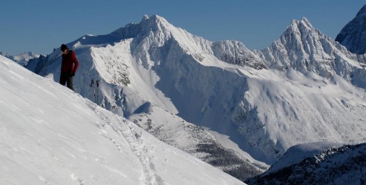
Guidebook author, Doug Sproul (aka the Wolverine), in his natural environment on Cheops -- photo by Renaud Paradis. Used with permission.
Rogers Pass is considered to be one of the world’s meccas for ski touring. Located in Glacier National Park in British Columbia, Canada a major highway winds its way through the park topping out at Rogers Pass at 1330m. From that pass and from various access points located close to the highway, multiple ski touring zones can be accessed. Huge peaks, icefields and slidepaths l00m kilometers above the land.
The ingredients of terrain and copious snowfall (averaging 10m of snowfall/year at the pass, 14m of snowfall/year at the Fidelity snowplot at treeline and snowing an average of 141 days of snow a year) make for paradise. Rogers Pass North by Doug Sproul of GeoBackcountry.com is the first installment of a guide to the area.
Glacier National Park (GNP) is located in the Selkirk Mountains (identify yourself as a geographical noob by wrongly referring to the range as the Rockies). The Selkirks are known for high prominence, aesthetic sculpted beauty and ridiculous amounts of snowfall. Weather systems come in from the west, pick up speed as they barrel through the useless (from a skiing point-of-view) flatness of the Merritt to Salmon Arm leg and then slam into the Monashees just west of the Selkirks and then into the Selkirks themselves. The storms are funneled into an east-west natural drainage past the town of Revelstoke. The precipitation laden clouds then annihilate themselves against rock walls of the Avalanche — MacDonald group as the drainage takes an abrupt north—south leg at Rogers Pass. The pass itself is where the storms go to party.
The ingredients of terrain and copious snowfall (averaging 10m of snowfall/year at the pass, 14m of snowfall/year at the Fidelity snowplot at treeline & snowing an average of 141 days of snow a year) make for paradise. Rogers Pass North by Doug Sproul of GeoBackcountry.com is the first installment of a guide to the area.
The guidebook’s content is so rich and deep and the way in which it is presented so unique and novel that I’ve found myself unable to write a review of reasonable brevity. Accordingly this review is presented in two parts. The first part describes Rogers Pass North in the traditional sense that many will use it — as a traditionally laid guide presented in e-book PDF format. The second part will describe the free KML file accompanying the guide and Rogers Pass North in its form as a mobile optimized guide.
A Colorado boy in his formative years, Douglas Sproul heard the call of big mountains 20 years ago and came to Canada. In his first year (June 1994), Doug and some friends ended up in Whistler. Craving a little less glamour his crew was told about this little known town in the BC interior called Revelstoke. Driving into town in dark they pulled off the road camping on a spit of the Columbia River in the dark. The next morning, the sky was alight with the fire of sunrise. A friendly local greeted them, laughing at the piles of ski gear scattered over the road. He pointed at the Monashees and the Selkirks and told them that’s where you want to be.
The next day, with huge packs and camping gear fresh from Army and Navy off the crew went to Sapphire Col stumbling through glaciated terrain and into the teeth of a driving summer rain storm. Thirty mm of rain proved too much for even Army and Navy quality so off the crew staggered back down to the parking lot. They did meet with success at Moraine Lake skiing some of the Twenty Dollar Bill couloirs.
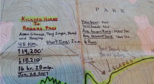
Doug’s come a long way since then establishing himself as one of the backcountry ninjas that every BC town seems to have: outdoorsman with dogged persistence, tenacity and skill. In December of 1995, he moved to Rossland spending a lot of time skiing at Whitewater and Red. After that he spent four winters in Nelson and Golden alternating time between Canada and the US. Doug now makes his permanent residence in Revelstoke with significant other and number one fan, Trace P. In the meantime Doug’s steadily accumulated an insane amount of knowledge about the mountains, both in summer and winter. Credited with some remarkable ski mountaineering accomplishments (north face of Tupper, speed traverses of the classic Bugaboos to Rogers, south face of Sir Sandford) Doug was inspired to take his knowledge and reams of random scrawls on dog-eared maps into a guide of the mountains that he loves.
The result is the guide, Rogers Pass North.
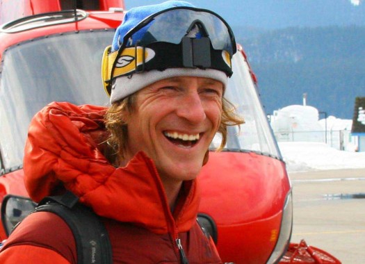
Geobackcountry's author, owner and chief dishwasher - Douglas Sproul. Photo by Ole Hesbol, used with permission.
Rogers Pass is not for rank beginners, and to his credit, the author does not gloss over that. Lots of information is presented in a consistent graphically-heavy format. Descriptions are accurate and, once you get used to the overall scale of the terrain described, brutally realistic. The guide’s style is such that the author expects the guidebook reader to read the entire description and have basic map/picture reading skill to figure out how to assess and accomplish objectives. Put simply, there’s not that much hand-holding going on here.
To expand on this, in terms of inclusion, no holds are barred when including routes or proposed routes; even exceptionally difficult trips are described. For example routes culminating in mandatory rapped entries, exits or heinous bushwhacked starts or finishes are described in laconic, clinical choose-your-own-adventure prose. There’s a refreshing honesty in the author’s understated ability to describe you-fall-you-die terrain and point a way for the reader to find her own path down it. Having said all of that, Rogers Pass North is an exceedingly comprehensive guide. The majority of trips described here are difficult because of the nature of the touring terrain at the Pass. For the rest days, there are some (not many) easier tours and the author doesn’t hold back on those; also describing how to access and enjoy those tours.
The guide shouldn’t just be read for its description of routes. If you pay some attention to the “Techniques” section what shows is the author’s passion and dedication to his craft. It’s a labour of love and expression of Doug Sproul’s respect and awe for mountains married with eminently practical advice for getting up and down ultra-technical terrain safely described in Mark Twightian fashion. However, the author isn’t just a mountain-man but also a closet tech-geek. What is most novel about this guide is how Doug Sproul has delved into the world of KML, KMZ, Google Earth, mobile content, mapping, terrain photos and GPS to lay out a different paradigm for how to use information, not just in isolation but as an entire package. You’ll have to read further to Part 2 to get a flavour of how this information technology integration works.
Rogers Pass North can be bought as a static PDF e-book for $ 25. It contains standard content: maps, terrain photos and route descriptions. Many people will use the guide in this configuration and not look at the KML (free) or mobile content derivations (separate purchase). This isn’t such a bad thing because the reader will quickly find that the author has included an overwhelming amount of information. Give the guide a cursory glance and you can still get a lot of use out of it, at a relatively superficial level but yet still deep enough for the user to get information about interesting and challenging tours. Immerse yourself in it and give the guide more time and it’s like peeling back curtains to a stage. Possibilities will expand as more and more terrain unfolds itself before you as the pages turn.
For many people Rogers Pass North will be used by simply printing out the information needed. It’s the good old-fashioned reliable way. Some of the more notable details and notes about the guide in its PDF book format follow:
GPS datum is WGS84. Units are metric (although freedom units are occasionally used).
The start is a basic primer talking about the general layout of Rogers Pass and how it is divided up into zones delineated by either geography, convention, or Parks Canada names. Because GNP is highly regulated it pays to know the permit system which the guide describes in detail.
The content of Rogers Pass North is divided up into zones. The PDF book divides content into Sorcerer, Wolverine, McGill, Ursus, Rogers, Cheops. Confusingly the mobile app’s zones are different: McGill, Cougar, Ursus, Rogers, Sir Donald and Asulkan. My recommendation is that any user of the guide best have a general idea of the lay of the land before getting there, have some idea of conditions and what is open, and have some idea of what he wants to ski. It would be a monumental hassle to have an intended trip description and map printed and then not have information at hand if trip plans have to change. Pretty hard to find a printer while stuck in the Asulkan Hut in the middle of a sudden weather event!
Maps are TRIM 1:20,000. To be technical they are They are geo-referenced with a linear grid, but as PNG images they do not contain Geo-referenced digital data. Some of them can be very crowded (lots of information embedded) but they are an improvement to the 1:50,000 official maps both in clarity and level of detail.
Speaking to the information presented, there is no shortage of general information about the Pass presented, including for example, designated access routes, the permit system, avalanche control, road closures and avoiding rail traffic–all things designed to make your experience just that bit better.
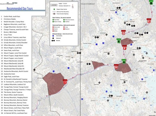
Recommended Day Tours is undoubtedly the reference that most people will use. This list is, of course, the author’s opinion and an interesting insight into his belief in individual responsibility; many of the most difficult routes in North American ski-mountaineering are represented here with some of the you-fall you-die difficulty level.
As previously mentioned, the author includes many vignettes of the ruthlessly practical and opinionated variety. His advice is based on years of practice and experience and not for everyone (read the Techniques section starting at page 80 about dealing with “Steeps” especially in using mountaineering techniques for ski objectives). There’s also lots of good information on dealing with heinous character-building approaches and exits which should give you a hint of what to expect from the character of the author’s trips. Consider yourselves warned! You’re shortchanging yourself if you don’t kick back and read some of this stuff.
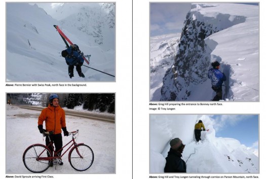
No holding back on you-fall-you-die terrain. The North Face of Swiss Peak presents objective hazards on approach, descent and exit. Most guidebooks won't describe a run of this magnitude.
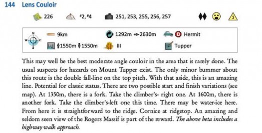
I love this guy! Look at the Lens Couloir description: "At 1350m there is a fork. Take the climbers right!" No braggadacio, no sandbagging!
Guest blogger Lee Lau is an avid skier and outdoorsman embarking on many adventures with his loving, and sometimes concerned wife, Sharon. He has over 15 years of experience skiing, ski-touring and dabbles in mountaineering. In the “off-season” he is occasionally found working in his day job as an intellectual property lawyer when he is not mountain biking. As a resident of Vancouver, British Columbia, Lee’s playground extends mainly to Western Canada, including South West B.C. and the Selkirks.

