Anton Sponar
Standing in the airport parking lot with the Mexican coastal sun beating down on me, I began to wonder if I was really on a ski trip. I usually don’t wear shorts and flip flops while dragging my ski bag through terminals. Jordan White, Caleb Wray, Dave Rasmussen and I had decided that skiing off of Mexico’s two highest climbable peaks was a good way to spend our fall off-season. The cheapest plane tickets we could find were to Puerto Vallarta, some 500 miles away from our objectives. Well, this just adds to the adventure. Right?
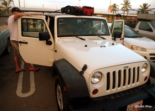
We rented a 4 door 2wd Jeep Wrangler, loaded gear on the inside and strapped what remained on top of it and headed east we went. Click to Enlarge.
The transition from coastal jungle to desolate desert plains to the smog and bustle of Mexico City was spectacular to watch out of the windows of the Jeep (or “eep” as we called it since it was missing a letter on the hood). After a few wrong turns, and a twenty dollar bribe of a corrupt police officer we arrived at the sleepy town of Amecameca at the base of Iztaccihuatl (or Izta for those of us who have no idea how to pronounce the real Aztec name). Izta is an extinct volcano that stands at 17,342 ft. It is the third highest peak in Mexico behind its neighbor, Popocatepetl (illegal to climb due to the fact that it is erupting), and Pico de Orizaba. It is a popular warm up climb for Orizaba, and this was the main reason for our visit.
We acquired our climbing permits in Amecameca and coaxed the Jeep up to the climbers’ hostel at 13,000 ft near the base of the mountain. We were not alone however; a small black puppy, who instantly sensed that we had food, became our new friend.
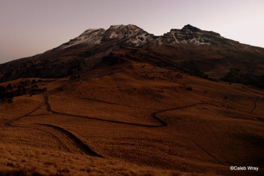
The next morning we awoke to our first view of the peak. The same thing occupied all of our minds at once: “Not much snow up there.” Despite our doubts, we strapped our skis and boots to our packs and began to walk at about 6:30 am with our little friend in tow.
The normal climbing route gains the south ridge and goes over many false summits to the true summit. The majority of this route is over 16,000 ft, and does not offer much in the way of downhill skiing. We opted instead to take a lesser climbed route that traverses below the ridge on the west side of the mountain to the base of the Ayoloco Glacier, directly beneath the summit.
We were slightly dismayed to find that we first had to decend steeply about 500 feet into a drainage, and then move back up the other side before being able to start the traverse. There was a small dusting of snow from the night before which made the trail quite slick. After hours of sliding around and route finding we found ourselves at the base of a huge scree field with the glacier about 700 vertical feet above us.
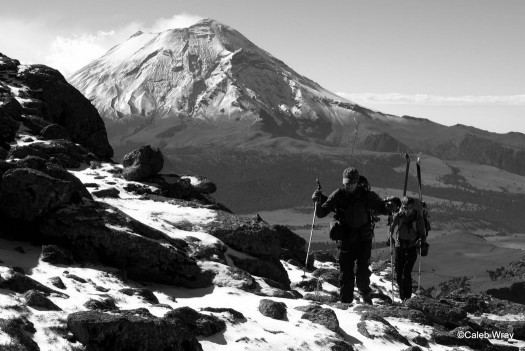
Dave and Imaking our way through some Talus with the view of Popo behind us that never really seemed to get old.
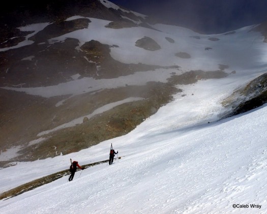
Scree is never fun on the up, but we found it to be extra difficult at 15,500 feet with a layer of new snow and our skis and boots on our backs. I think at this point we were all wondering just what Ayoloco means, perhaps foolish gringo? We stumbled and cursed our way up to the glacier. Our friend, the puppy, seemed quite amused at our difficulties.
After an eternity we found snow! Finally we ditched our shoes and put our ski boots and crampons on. The puppy didn’t want anything to do with the snow, so he stood guard by our shoes as we began up the glacier. We were able to move quite quickly up the 700 vert to the summit ridge.
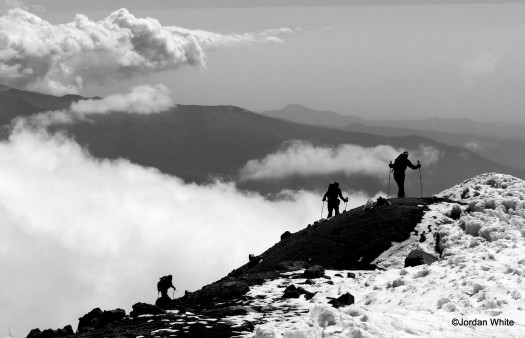
As we moved along the ridge whispy clouds billowed at our feet. With slight headaches from the altitude we made our way along the ridge to the summit.
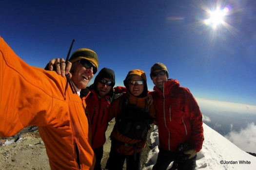
Once at the top we were not sure which of the three high points was the highest. This is when Jordan took a page from the Dawson book of tricks. He grabbed his Nalgene and by using the measuring marks made the water as flat as possible. By looking across the flat water towards the other points we could see that one of them was lower, while the other seemed the same. So we loaded up and made our way to the other high point. Since we were now sure that we had been to the summit, whichever one it was, we were able to take in the views, and they were amazing. To the south was the erupting Popo. In all other directions the Mexican plains extended as far as the eye could see 10,000 ft below us. To the East was Orizaba. We couldn’t help but notice how much more snow there was there than where we were.
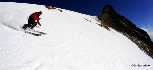
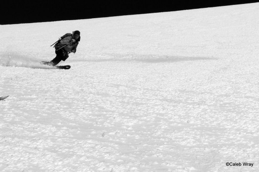
We had skis and some snow though, so we started to make our way down. Blessed with perfect corn snow, we skied down the Ayoloco to our shoe stash and our guard dog.
Needless to say we were not stoked to have to walk the rest of the way to our “eep.” Switching to shoes, we began the trek.
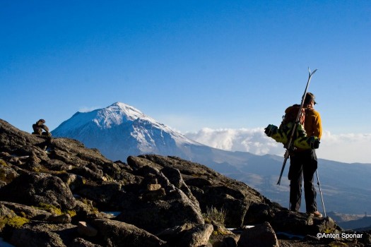
Caleb taking a look at the knee pounding that lies ahead. I guess suffering is half the fun in the mountains.
With all the downhill scree walking, my knee began to act up. I hung back behind the rest of the group trying to enjoy the beautiful scenery.
I made it back to the Jeep at around 7 pm, over 12 hours after we had begun. We gave our puppy a congratulatory pile of tortilla chips and took off towards the nearest street taco stand.
Izta was a bit of a slog that didn’t offer much skiing but was good acclimation. All of us were quite happy to have completed this when a couple days later we found ourselves on 18,500 ft Pico de Orizaba without much notice of the altitude.
The next morning we awoke feeling more refreshed and decided that we had better head on towards Orizaba since there was going to be some pretty serious four wheeling to get there. You can find the rest of the story here.
(Guest blogger Anton Sponar is an Aspen native who has been on skis as long as he has been able to walk. Recently he has learned that in order to ski many of his objectives, his climbing had to improve, and so it has. Last December Anton skied off the top of Aconcagua and all the way down the Polish glacier. When he isn’t skiing in CO he and his father run the only Cat-skiing operation in Chile; Ski Arpa.)
Beyond our regular guest bloggers who have their own profiles, some of our one-timers end up being categorized under this generic profile. Once they do a few posts, we build a category. In any case, we sure appreciate ALL the WildSnow guest bloggers!

