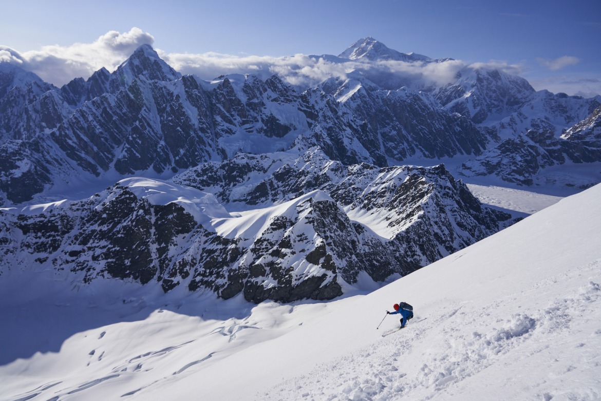
Finding sunshine and stable snow on Mount Dickey’s West face; Ruth Gorge, AK. Photo: Austin Mallet.
As a navigation tool, CalTopo offers a complex feature set that sometimes takes time to hone. With a little savvy, CalTopo’s hidden gems make backcountry skiing/riding trip planning more useful. Here are four specific features to dial in your ski and winter climbing plans.
I spend a lot of time on CalTopo. Like, more than anyone should. For me, it’s an invaluable tool to plan future skiing and climbing trips. The mobile app is slightly less polished than Gaia, but I love being able to make separate files for different mountain ranges; it’s hard to beat the organization features of CalTopo. I’ll even go as far as to make a separate map file for upcoming trips making visible only the elements applicable to the planned objectives. Sometimes, it makes sense to get granular with a tool like CalTopo. It is powerful. The “secret” features I’ll discuss in this article aren’t hidden by any means; they’re just features I find valuable that some maybe haven’t unearthed.
Feature 1: Sentinel Weekly Live Satellite Imagery Satellite
I love using the “Sentinel Weekly” satellite imagery to investigate late-season skiing conditions. The Sentinel satellite imagery isn’t the highest resolution, but it’s updated every few days, allowing you to gauge current conditions. You can use it to evaluate if there’s enough snow present to warrant a long walk with skis on your back, and also use it to nail down the exact point/ elevation where snow starts. The images below show The Blaze, a popular summer ski destination in SW Montana. CalTopo stores all the historical imagery back to 2017, which is great for comparing the current conditions of a ski line compared to when you skied it in, say, June of 2021. In the images below, the “Contours” layer is overlaid to add more definition.
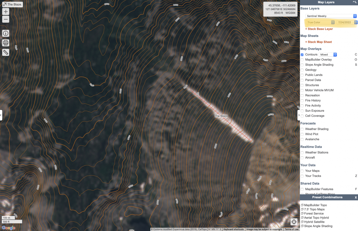
Sentinel Weekly Satellite Imagery from 7/25/2022
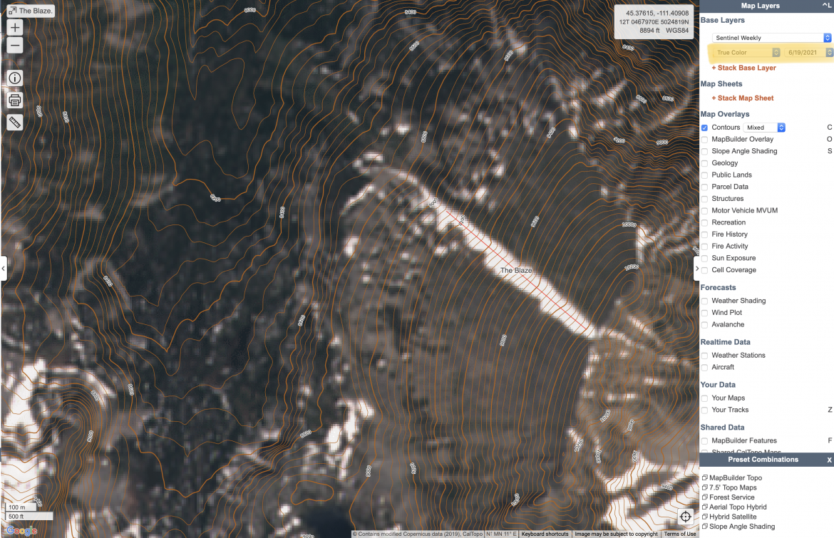
Sentinel Weekly Satellite Imagery from 6/19/21
Feature 2: Sun Exposure
For spring ski-mountaineering, sun is the name of the game. Nailing the timing to allow a line to soften up, but not warm up so much that stability is lost requires precise timing. A prime example is the Ford-Stettner Couloir on the Grand Teton. The upper portion is more of a bowl feature; everything funnels into the narrows below. The “Sun Exposure layer” on Caltopo is a fantastic tool to evaluate when a line starts seeing sun. You can select the month and adjust the time of day to visualize how sun exposure changes throughout the day. It also serves as an essential tool to highlight how different parts of a ski line receive vastly different amounts of sunlight based on aspect. Below, you can see by 8:30 AM in April, the upper portions of the Ford Couloir and the Chevy Couloir on the Grand Teton receive sunlight, while the lower Ford Couloir and the Stettner are shaded. (The often used ascent route to ski the Grand ascends, in order, the Stettner, Chevy, and then Ford couloirs.)
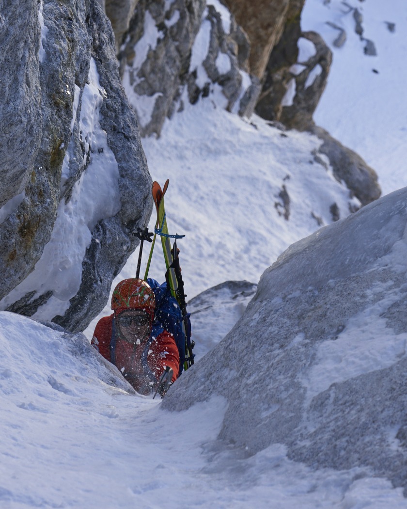
Deep in the tapered funnel that is the Ford-Stettner on the Grand Teton. Photo: Austin Mallet.
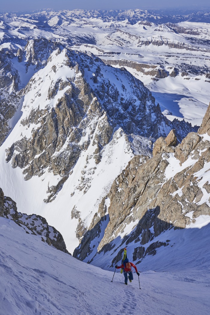
On the upper flanks of the Grand Teton, in the wide open portion of the funnel. Photo: Austin Mallet.
It’s easy to get lulled into a false sense of security when you’re shivering in the shade low on a line, but there could still be considerable overhead hazards from the slopes above heating up. I also used this tool to plan my trip to the Ruth Gorge in Alaska this spring to select a location for a base camp that would receive the maximum amount of evening sun. The opportunities are endless.
In the images below, yellow=direct sun, blue=shaded.
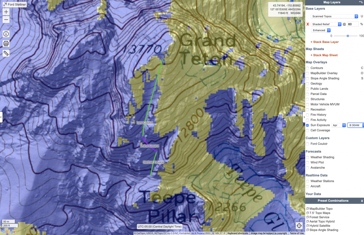
Sun Exposure on the Ford Stettner Couloir.
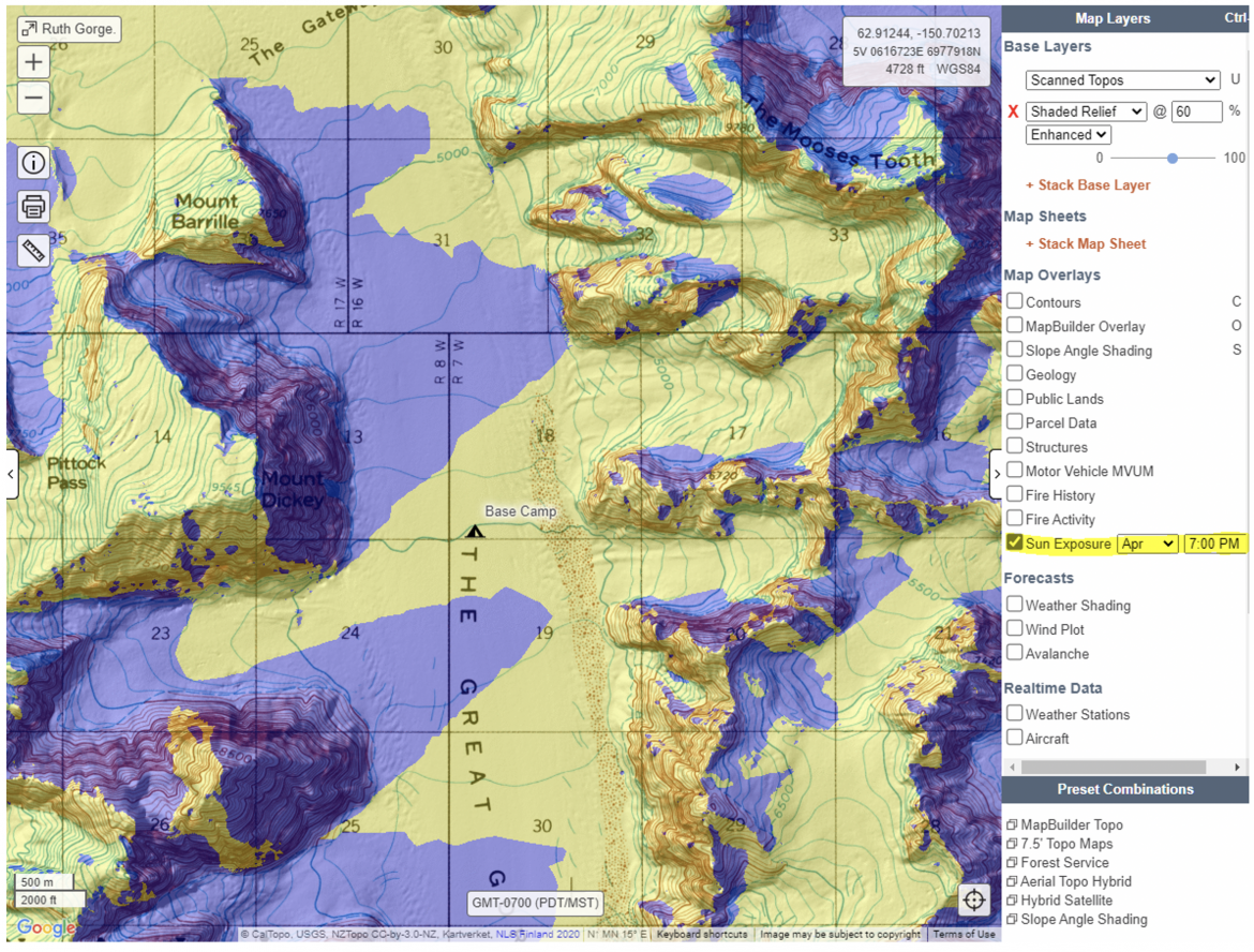
Sun Exposure on the Ruth Gorge.
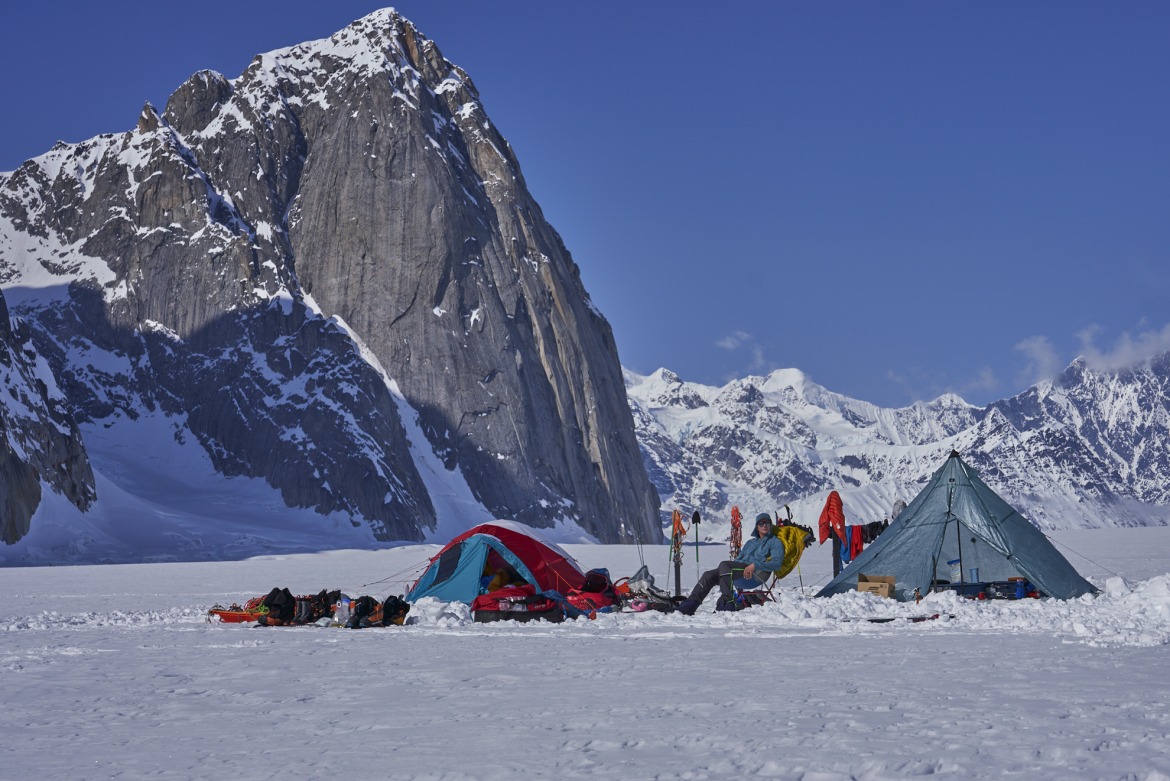
The Ruth Gorge equivalent of the beach: A+ views and sunshine— CalTopo helped find both. Photo: Austin Mallet.
Feature 3: Viewshed Layer
Whenever possible, it’s always advantageous to put eyes on a ski line before committing to the approach. Even better is scoping out a line from the comfort of your vehicle, assisted by binoculars or a spotting scope. To determine what sections of the road a ski line is visible from, first right-click on a point centrally located on the ski line and select “Viewshed Layer.” From here, you can name the layer and select the eye altitude. If planning on scoping the line out from the ground, select 2m for the eye altitude. If you plan to climb a tree to get a better vantage point, select the tree’s height. Once created, the layer appears in two places: “Terrain Modeling” on the left menu and “Custom Layers” on the right menu. You can also change the color of this layer to optimize visibility.
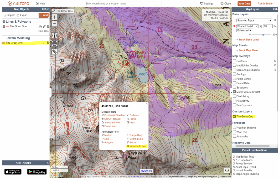
In this viewshed layered map (The Great One), the purple shaded area denotes the terrain visible from a specified (altitude adjusted) point.
Feature 4: Export KML* Network Link to Google Earth
Google Earth can be extremely valuable for sensing specific terrain from behind the computer screen. Caltopo has a handy feature to export a “KML Network Link” to Google Earth which automatically updates the Google Earth application with any changes you make to your Caltopo file. Note: this only works on the Google Earth desktop application, not the browser-based or mobile device software.
The Google Earth satellite imagery isn’t quite as detailed as the “Global Imagery” layer. Still, viewing terrain in three dimensions helps immensely with spatial awareness when scoping out ski lines or approach tracks.
If you have a CalTopo Pro Account (which I highly recommend), you can also view Caltopo layers in Google Earth. CalTopo refers to these as “Super Overlays,” and I agree with the term. The layer I view most often is slope angle shading, but many other layers are available. Again, it’s hard to beat three-dimensional maps when trying to comprehend complex terrain from behind a computer screen.
(CalTopo does not feature 3D maps, something I know skiers/climbers frequently view on tools such as FatMap, onX, and Gaia’s web-based platform.)
*KML is a specific file format for displaying geographic data.
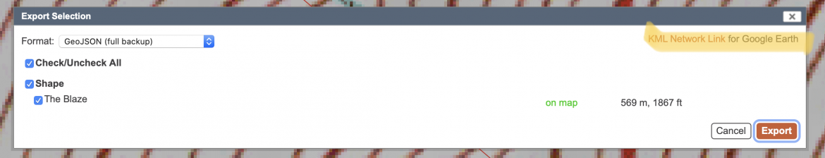
A screenshot highlighting where you’ll find the KML Network Link for Google Earth.
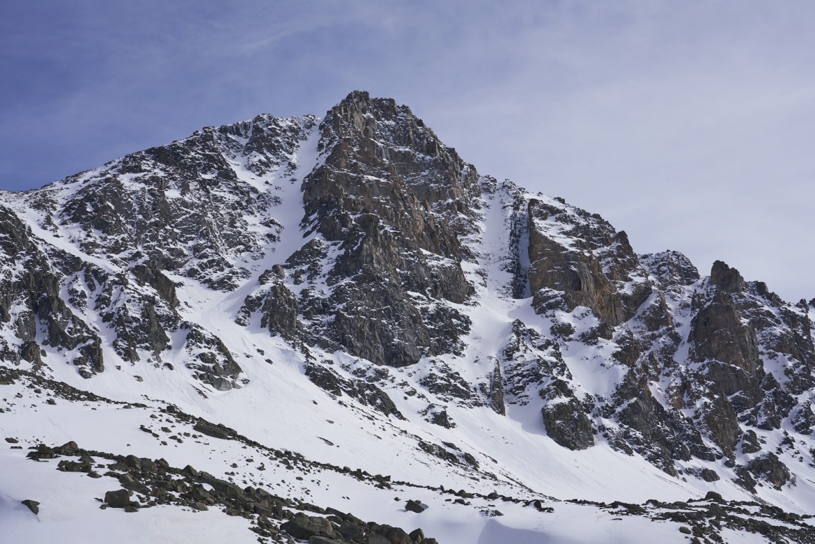
North Couloir of Whitetail Peak (left) in the Beartooth Mountains.
In the images below, we see three renditions of Whitetail’s North Couloir: Which below looks more the like real thing, CalTopo, Google Earth’s 3D,
or Google Earth with Slope Angle Shading? In any event, the line is steeper than it looks.
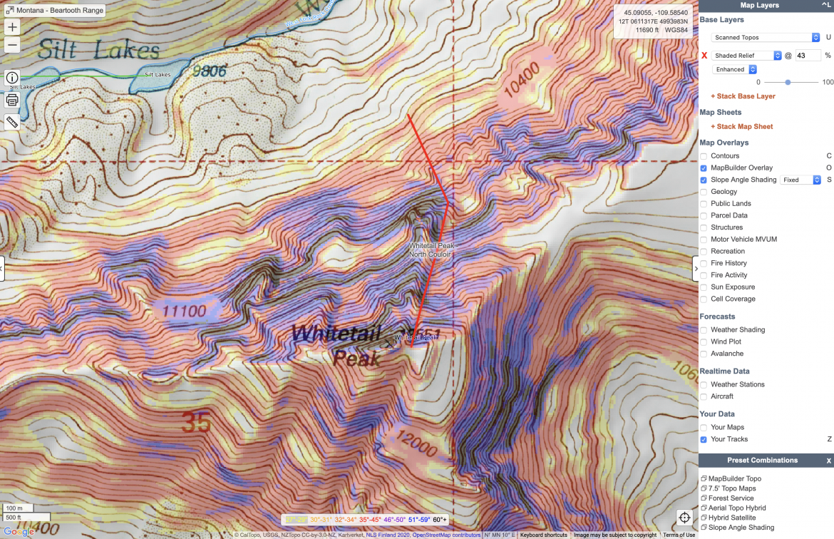
CalTopo’s rendering of the North Couloir of Whitetail Peak.
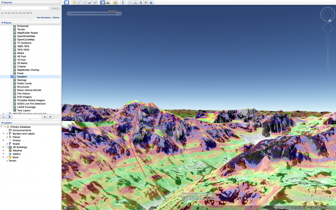
Whitetail Peak with Slope Angle Shading on Google Earth.
Behold the digital tools at our fingertips. With many options out there, find what works for you, and try to implement it into the planning phase of a single day or multi-day tour. Onward.
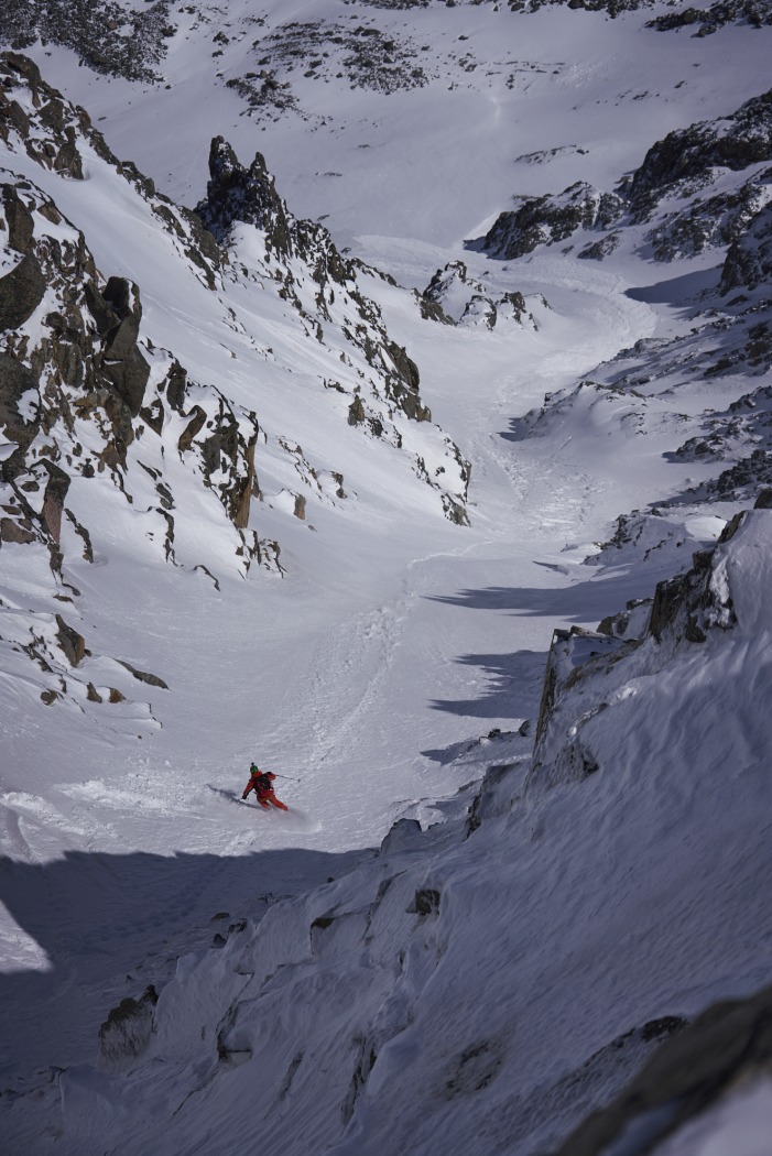
In the end, it’s about the turns. CalTopo and Google Earth helped plan the excursion, yet Mother Nature and some lung busting did the rest: a fine descent of Whitetail’s North Couloir. Photo: Austin Mallet.
Austin Mallet is originally from the flatlands of Houston, TX. Once the career opportunity presented itself, he moved to Bozeman, MT and never looked back. It didn’t take long to fall in love with the mountains and all the activities they have to offer. While living in Texas, Austin raced road bikes so it was an easy transition into the spandex clad world of skimo racing. These days, Austin is most passionate about climbing (specifically in the alpine) and ski mountaineering with a little trail running mixed in for good measure.