Picture this scene: After a slow start to the season, you’re beginning to find your ski legs and are psyched for winter to arrive in force. The holiday crowds die down, the new year dawns, and then… the forecast goes dry. June-uary. In between breakable crust laps and re-applications of sunscreen, your friend breaks the silence while scrolling through their Instagram. “Well, it’s dumping in Jackson…”
Sound familiar? We’ve all dreamt about spontaneous pow-chasing trips to the Tetons, one of the Meccas of backcountry skiing and snowboarding in North America. But the idea can also be daunting, as the Tetons have a reputation for being big, gnarly, and avalanche-prone. TGR flicks instill the notion that these mountains in western Wyoming are only suitable for elite backcountry skiers and riders, those willing to huck cliffs and outrun avalanches in pursuit of powder nirvana.
Of course, hundreds of backcountry travelers safely enjoy these mountains every day of the winter while keeping both skis on the ground. Here are some recommendations for planning and executing the backcountry trip of a lifetime to the Tetons.
Start on the Pass
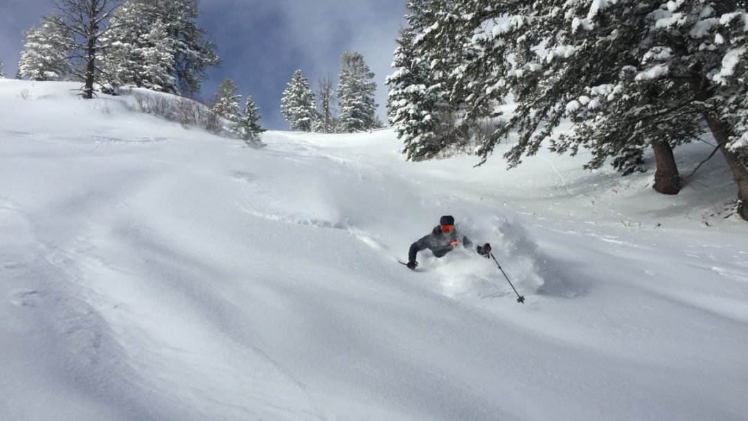
Teton Pass, between Wilson, WY and Victor, ID, is the best place to start while on a backcountry trip to the Tetons, and is the largest backcountry zone in the area. This legendary venue features some great steep skiing, but also has tons of low-consequence terrain and tree-skiing. It’s perfect for dipping your toes into the Teton snowpack without necessarily exposing your group to avalanche terrain. Skinning south from the parking lot at the pass, you’ll be on top of 30-degree bowls and 25-degree glades in less than an hour. There are also steeper bowls and chutes to explore if your crew feels comfortable with conditions and stability. Follow a skin track back up to the parking lot, or drop off the backsides of these summits for more untracked runs and more extended tours.
Parking at the pass is the best way to access bowls and glades off the summit of Mt. Glory, which is reached by a 1,655 vertical-foot bootpack straight from the parking lot. The climb is reasonable, and average times range from 45 minutes for the fittest to just over an hour for those of average fitness. The terrain off the west side of the summit is generally more benign than the peak’s east aspect, rarely exceeding 35 degrees. It also provides the longest runs on the pass, up to 2,900 feet.
In general, the backcountry culture around the Tetons is friendly and welcoming, a far cry from the aggro feel of JHMR. This camaraderie often surprises visitors, who show up expecting a “locals only” vibe. Teton Pass regulars are usually happy to point visitors in the right direction, share ideas for good tours, and explain the well-established ethics of the area. Local skiers regularly coexist with highway department workers, avalanche forecasters, and commuters on the pass. Arrive with a respectful and humble attitude, and you’ll be rewarded with good vibes and plenty of information.
That brings us to the east side of Glory, which dominates the “bowl”, a menacing avalanche path that crosses the highway. Glory Bowl and Twin Slides path (adjacent to the bootpack) regularly avalanche onto the road. Local backcountry ethics mandate that these paths are skied only during periods of exceptional stability. Increasingly, the local community avoids these runs altogether.
Hitchhiking is a common and accepted method of travel on Teton Pass. Since most runs start at the top of the pass and end near the bottom on the east and west sides, there are two ski-day strategies to choose: Arrive early, park up high, and thumb a ride back up after your ski; or sleep a little later, park in lots near the bottom of the pass, and hitchhike to the top to start your day.
Wyoming route 22 over Teton Pass is heavily trafficked, and hitchhiking is reliable. Bring a mask, be prepared to ride in the back of a pickup truck, and give rides to others whenever possible. Of course, you could skin to the top of the pass as well, but that will add an hour and a half, and 1,500 vertical feet of climbing, to your day.
Two modern guidebooks to the area can be purchased at local backcountry ski shops like Skinny Skis and Teton Mountaineering in Jackson, Wilson Backcountry Sports in Wilson, and Yostmark Mountain Equipment in Driggs. The Teton Pass Backcountry Guide, written by local legend and Exum Guide Tom Turiano is the comprehensive guidebook with route descriptions and photos, while the Jackson Hole Ski Atlas is a collection of aerial photos and names of features, but lacks route descriptions.
Lift-accessed Backcountry
Jackson Hole Mountain Resort and Grand Targhee offer some of the best lift-accessed backcountry in the US. However, most sidecountry in the range is serious avalanche terrain, with few low-angle options. Skiers and snowboarders are regularly caught, carried, injured, and sometimes killed in the backcountry terrain directly adjacent to ski area boundaries in the Tetons.
The southern boundary of JHMR is home to Cody Peak, Rock Springs bowl, and fall-line terrain that funnels back into the ski area. This venue is accessed top-down from the top of the tram, can’t be previewed on the uphill, and includes mandatory sections of travel through challenging or complex avalanche terrain. However, the easy access to this zone also means it gets skied regularly, and any terrain that can be accessed without uphill travel will be bumped-out after every storm. If you bring your skins and are prepared for 30-minute ascents, you’ll quickly find untracked terrain.
The northern boundary of JHMR is adjacent to Granite Canyon, which hosts loads of north-facing avalanche paths, many of which terminate in cliffs. Granite Canyon is serious terrain, and multiple people are stranded overnight each season in this complex zone. A stable snowpack and a trusted local to show you around are mandatory before venturing into this area.
Grand Targhee, outside Driggs, Idaho offers more limited backcountry access. Nearly all of the north-facing runs are short, avalanche-prone, and are often guarded by touchy cornices.

In Grand Teton National Park, 5,000 vertical feet of fall-line skiing is not the exception, it’s the norm.
Grand Teton National Park
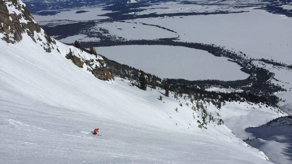
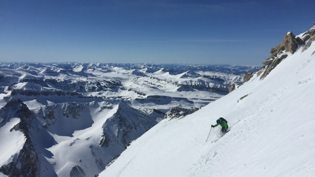
The Teton skyline is perhaps the most famous mountainscape in the US. And within its heights, backcountry skiers and ski mountaineers enjoy one of the great alpine venues of the world. A glimpse of the central Tetons indicates it is some of the most serious and consequential terrain many people will ever ski. From the iconic classics like the Ford-Stettner couloir on the Grand Teton, the East Face of Buck Mountain, and the Skillet Couloir on Mt. Moran, to modern favorites like the Sliver Couloir on the east face of Nez Perce and the Banana Couloir on Prospector Mountain, a trip to “the Park” should be on every skier’s bucket list. The alpine season for the big lines starts in March and lasts through April, and the lines on the tallest peaks often remain in good shape through mid-May. Expect to climb between 4,500-6,000 vertical feet from the valley floor to alpine summits.
Mid-winter, the Park offers good powder skiing, but few options exist for limiting avalanche terrain exposure. Riddling the east-facing 30-degree powder slopes of Peak 9975’ and Albright Peak are convexities and terrain traps that produce frequent slides. If venturing into Grand Teton National Park mid-winter, plan your route meticulously, remain vigilant about route finding and snowpack observations, and be prepared to bail if uncertainty arises.
The main Park trailheads are about a mile from the base of the peaks, so allow about 30 minutes to navigate the flats. Average vertical relief is about 3,000-3,400 feet for the east facing glades. Park days are often long and stressful, but the rewards of skiing in this alpine paradise are worth the effort.
There’s no guidebook (yet) to skiing the Peaks of Grand Teton National Park, but TetonAT.com hosts dozens of trip reports, including almost every skiable peak in the range. This site was the project of the late Steve Romeo, a prolific Teton ski mountaineer and mentor to many in the area. Locals still use his trip reports to find beta for difficult ski mountaineering objectives.
Planning Resources
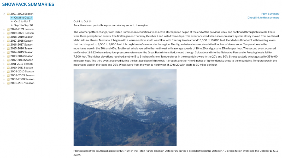
The sheer amount of skiers and riders that come to the Tetons each winter ensures that most avalanches are observed and reported, the snowpack is well-documented, and weather forecasts are accurate and reliable. The Bridger Teton Avalanche Center’s daily forecasts are helpful, and for visiting backcountry users, their weekly avalanche and snowpack summaries are priceless. Each week, the forecasters explain the narrative of recent weather events, snowpack characteristics, and the resulting avalanche activity trends. Before visiting the Tetons, be sure to read the entire season’s weekly summaries so that you are up-to-speed on the state of the snowpack.
The local avalanche event map is an excellent tool for catching up on the locations of recent slides, seeing photos of the mountains in real-time, and determining the scale of the avalanche problem. The RPK forecast from the National Weather Service is produced specifically for winter mountain travel in the Tetons and is generally accurate. For users who want more detailed weather forecasts than the BTAC daily hazard forecasts provide, the RPK forecast is what local professionals use.
If you are using Caltopo.com (or any other mapping/planning app) for planning tours and anticipating avalanche terrain exposure, remember that the contour lines on USGS maps denote 80-foot changes in elevation in the central Tetons, not the standard 40 feet.
Local guide services can provide safe powder skiing if conditions feel too daunting without local knowledge: Exum Mountain Guides and Jackson Hole Mountain Guides serve Teton Pass and Grand Teton National Park, while Yostmark serve the Grand Targhee sidecountry.
Don’t be daunted if the firehose shuts off in your local range and the Tetons are getting pounded. From low-consequence powder runs to the iconic steep-and-deep runs, there is plenty of terrain to explore. So saddle up, grab the powder boards, and I’ll see you in Wyoming.
Editor’s note: If you are headed to the Tetons this winter, please take the time to read up on possible ski zone closures.
Jeff Dobronyi is an AMGA/IFMGA Mountain Guide based in Jackson, WY. He has been a ski guide and avalanche forecaster with Exum Mountain Guides since 2017, and founded Spirit Mountain Guides to offer private backcountry ski trips around the world.
Jeff Dobronyi is an AMGA/IFMGA Mountain Guide based in Jackson, WY. He has been a ski guide and avalanche forecaster with Exum Mountain Guides since 2017, and founded Spirit Mountain Guides to offer private backcountry ski trips around the world.


