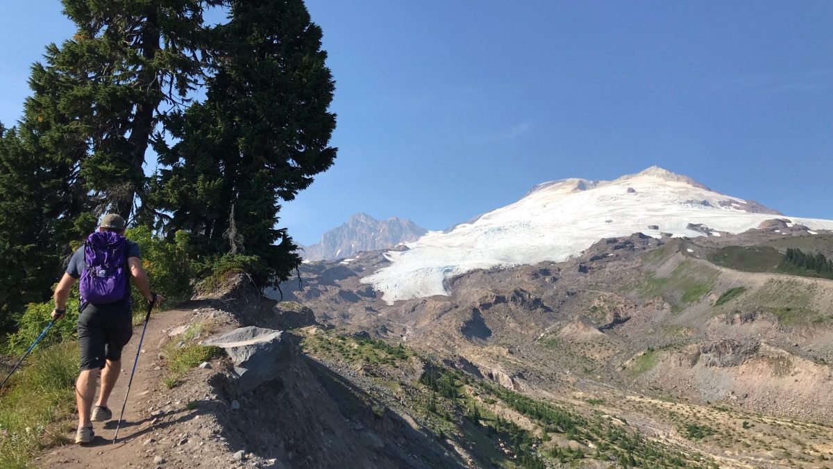
The ‘Railroad Grade’ trail to Easton Glacier runs along a glacial moraine. Carbon dating on rocks and trees that indicate that the glacier filled this valley as recently as 1900.
It was a day when we could watch the glacier melt. On the bumpy drive to the Park Butte trailhead on Mount Baker, the thermometer read 88 degrees. Doug and I hit our first creek crossing in the first mile, a thin but fast moving mud stream.
“Was it like this last time you came here?” Doug asked.
“Not that I remember,” I replied, but it had been a some years. A few minutes later, we came across another stream. Mosquitos taunted us as we bobbed from one slippery log to another.
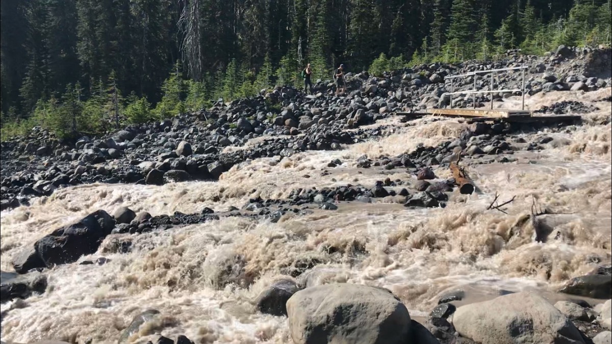
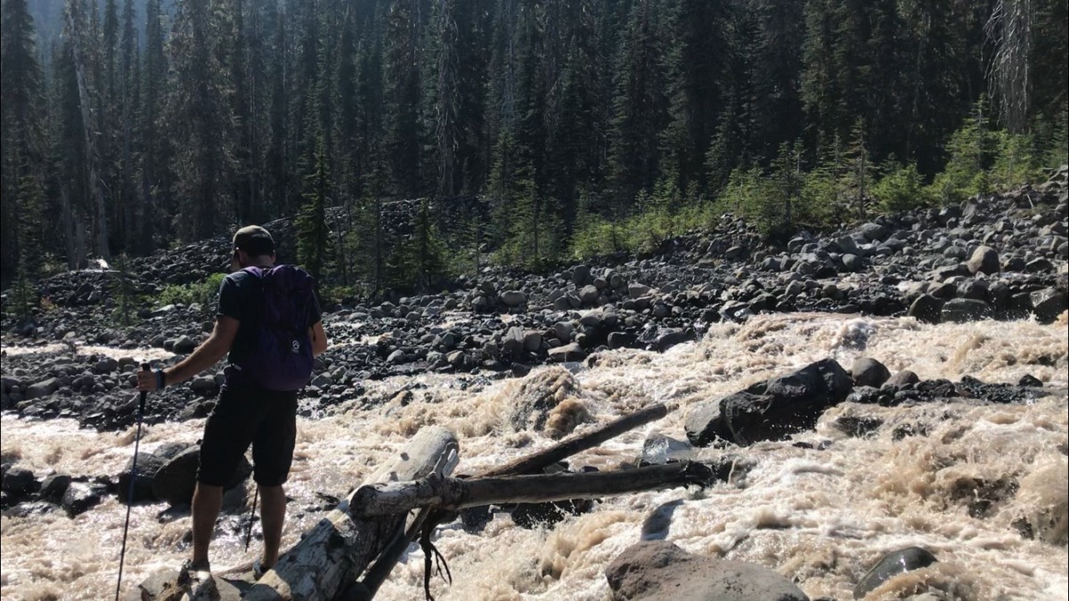
Keeping the shoes dry was energy wasted, we discovered, when we arrived at Sulfur Creek, part of the glacier’s outwash — a chaotic cluster of braided channels overflowing with muddy fresh glacial melt. A seemingly arbitrary hiker bridge sat in the middle of the torrent, water raging on either side. The roar was near deafening, like being inside a waterfall, with the ominous booms of boulders crashing together beneath the opaque surface. The only choice was to charge in.
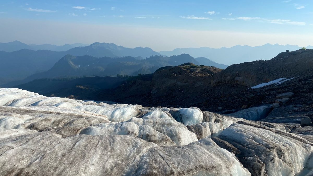
Four summers ago, about that same time in August, I’d visited Easton Glacier. Visiting glaciers in summer is something I’ve come to approach with a sort of morbid curiosity, particularly as the average temperatures in mountain regions creeps a little higher each season. I’d skied glaciers on Mount Baker in the late spring as well, but summer is when the glaciers become supercharged by sun and heat, and turn wild and dynamic. In summer you can really see a glacier and all of its weird colors, shapes, melt streams and crevasses.
If you haven’t experienced a glacier in summer, Easton is a good one to try. It is one of the most accessible glaciers in the lower 48, just over two hours drive from Seattle with only a tough 2.5 mile push before you’re standing on an old Ice Age moraine, gazing out on the cracked and ever-changing mass. It is a popular approach to climbing Mount Baker, though I’ve heard in late summer the glacier is broken up enough that increasing degrees of technical proficiency are required to reach the summit safely.
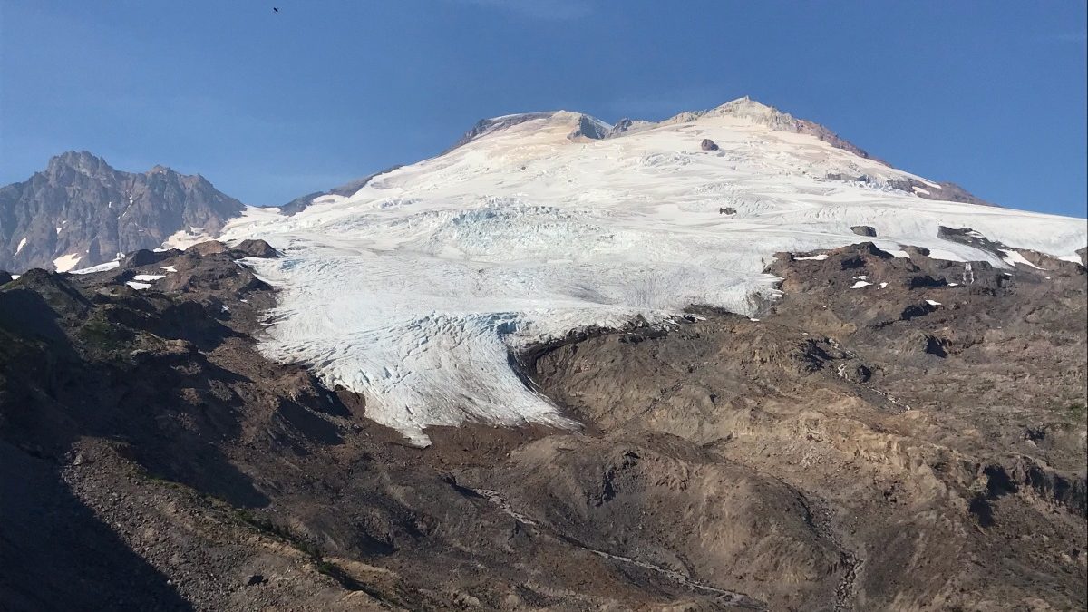
Easton Glacier is one of the most accessible glaciers in the lower 48 and a popular summer climbing route on Mount Baker.
Doug and I, though, we were just out for an afternoon walk on a hot afternoon to break up the drive from Seattle back to WildSnow HQ in Colorado. We’d nearly aborted the hike when wildfire haze grew so thick on I-5 it closed our throats and filled the air with the sick sweet smell of campfire. A fire had been burning for weeks just on the other side of the mountains, in Mazama, but there were countless others in the West that also fueled the haze. We carried on, though, and thanks to wind pulsing off the mountain we hit a clear pocket.
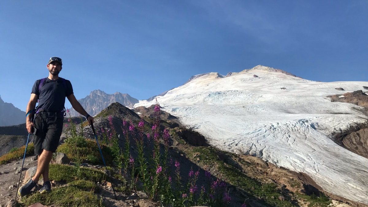
Perched above the outwash plain on a high moraine called the Railroad Grade, the roaring thunder of turbulent water echoed out of the glacial carved valley below. We spotted two streams pouring from the glacier’s dirty white toes that funneled into a towering waterfall. The glacier itself — a broad, tongue-like swath of white that extended to the rocky Mount Baker summit some 5000 feet above — glistened in late day sun. We hiked along the edge of it, aiming for a spot where we could easily get on the ice.
A glacier melting in summer is not unusual, though this summer has been a particularly hot one for the many moving bodies of ice inhabiting high alpine spaces and cirques in the Pacific Northwest. The 120 degree temperature anomalies of early June mostly melted feet of above average snowpack, but now in late August, ice is the primary meltwater source. Glaciologists estimate that the terminus of this particular glacier has been retreating 25-30 feet a year since the early 1900s, which, according to some simple math, is not an unsubstantial amount.
The trail splintered into climbers’ paths that crawled over and around moraine mounds. We passed a small tent city — a guided mountaineering group, I suspected — and slid down a patch of unconsolidated dirt and rocks. “Careful here,” I warned while pointing to the ground, “there’s ice underneath.”
(On a trip once in Alaska I’d slipped on ground like that — rock hard ice disguised by pebbles and rocks. My 70 pound pack and A-framed skis were no match for the inertia of the slip and I fell face first into the glacier ice, popping a contact lens out in the process. I hadn’t brought a spare and my group had flown in by bush plane. Whoops. A fervent five-minute search miraculously turned up the translucent lens.)
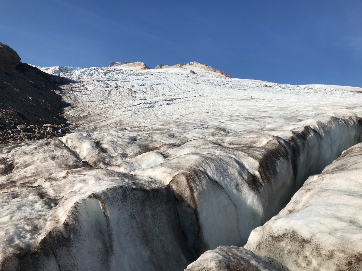
Doug and I hadn’t brought crampons and stepped gingerly onto the Easton. Streams glinted across the surface, some thin and nonchalant, others filling bottomless black cracks. We slid a few beers into one. Super charged cooler. A cold wind gusted from the summit, raising goose bumps on my bare arms and legs. We looked to the valley below us, filled with the dark tinted wildfire smoke we’d driven through. It was an odd juxtaposition, standing in cold clean air on a frozen body of ice while the forest literally burned to the east of us. Fitting for the off-key feeling of 2021, I guess.
If you go
Route: Park Butte trail to Railroad Grade
Distance: approx. 4 miles one way to glacier’s edge
Elevation gain: approx. 2600 feet to glacier’s edge
Land district: Mount Baker-Snoqualmie National Forest
Mount Baker National Recreation Area, Mount Baker Ranger District
Red tape: Northwest Forest Pass required in parking area
Read more Mount Baker trip reports
Manasseh Franklin is a writer, editor and big fan of walking uphill. She has an MFA in creative nonfiction and environment and natural resources from the University of Wyoming and especially enjoys writing about glaciers. Find her other work in Alpinist, Adventure Journal, Rock and Ice, Aspen Sojourner, AFAR, Trail Runner and Western Confluence.

