Using early season skiing for future avalanche awareness
Words and photos by Aidan Goldie
In Colorado, the high country seems to get its first dump of snow every year around September or October. For a brief moment, we get a glimmer of hope into the winter to come. For skiers willing to put in the work, there are even fresh turns to be had. But the early snow is a double edged sword, a blessing for our powder-deprived legs and a potential curse for snowpack stability. Venturing out into this impending persistent weak layer can provide critical information about the snowpack to come.
Observations from the field
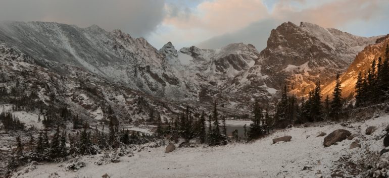
A cold September storm prompted us to drop our weekend plans and make a trip to the high country of the Indian Peaks. Driving through a dense fog and misty rain in Boulder Canyon, we emerged at the Brainard Lake Trailhead with a dusting of fresh snow. With the promise of more awaiting us up high, we set out through wet boulder-fields to chase fresh turns on Apache Peak.
With early season skiing, there’s often not enough base for skinning, which means you can end up carrying skis for 99% of the outing. Colorado’s perennial snowfields provide a base to harvest the early snow but lie hidden in hard to reach nooks and crannies of the Rocky Mountains. A light setup capable of descending steep and variable terrain is necessary. Of course, climbing to the top is only half the battle, so it’s valuable that you also trust your setup on a 45-degree slope above a jagged boulder field.
Carrying a light ski, binding and boot combo made the seven-mile approach more manageable. For this outing, I was using the 890g Scarpa Alien RS paired with a full-length lightweight ski and minimalist binding, the Dynafit Speedfit 84 and Superlight 2.0 binding.

Early season approaches mean lots of walking, with turns being largely limited to high north facing nooks.
On the Navajo Snowfield, we found 8-12 inches of fresh snow atop the hard, dense ice of the perennial snowfield. We took our first turns on a layer of ice that had not bonded well with the new storm snow. We quickly pulled an audible and found more skiable terrain by traversing to a sun-exposed part of the snowfield. A better-bonded storm layer was our ticket to our first powder turns of the season.
Early snowfall sets the tone for the avalanche season to come
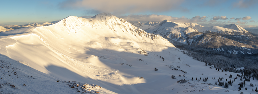
On the northern aspect of Uneva Peak, one can see an avalanche triggered naturally from a falling cornice. Wind-deposited storm snow and a weak layer from faceted October snow is a deadly recipe for instability. This was a common instability observed around the state following a heavy storm cycle in early November of 2018.

On the northern aspect of Uneva Peak, one can see an avalanche triggered naturally from a falling cornice. Wind-deposited storm snow and a weak layer from faceted October snow is a deadly recipe for instability. This was a common instability observed around the state following a heavy storm cycle in early November of 2018.
When early-season snow falls, forecasters and backcountry skiing enthusiasts around the state hope that one of two things will happen: 1. Either the snow doesn’t stop falling, or 2. It completely melts before the consistent storm cycles come in November. It’s rare for either of these scenarios, however. The dry continental weather patterns of the Colorado Rockies typically prevents storms from consistently rolling through. Even if the weather is warm, it is rare for the first snow to melt completely. This leaves pockets of old October snow scattered throughout the snowpack.
Why is this old snow such an issue? As time passes and nighttime temperatures dip, the shallow layer of snow lives under a steep temperature gradient between the warm ground (~0C) and the cold air above. Under this faceting regime (~1C per 10cm), water vapor is drawn towards the less saturated air near the surface of the snowpack which transforms snow into facets. In continental snow climates, we consistently see in these conditions in the early months year after year. The result is a weak and sugary layer of snow that acts as a field of loose ball bearings and lives at the base of our snowpack. Here, a layer forms that brings dread to the ears of any backcountry traveler: a persistent weak layer. This layer lies hidden in wait for weeks or months, until an adequate loading event pulls the rug from underneath a slab of snow on top of it, leading to a devastating avalanche.
Due to the unpredictability of slab avalanches, faceted snow at the base of our continental snowpack accounts for most avalanche accidents and fatalities. This year in Colorado, we had our expected early snow cycle in October, followed by a week of cold clear weather; a perfect recipe for a weak faceted layer at the base of our snowpack. Before the next storm cycle, be sure to take the opportunity to visit some of your local slopes to take note of the pockets that are holding faceted October snow. This kind of recon is key for determining what slopes can offer stability during the next big storm.
On the Navajo snowfield, we enjoyed a blissful run of soft and cold snow before the long walk back to our car. As therapeutic as these turns ended up being, the photos we took ended up being far more important. These photos allowed us to recall where those pockets of early season snow will collect, potential trigger points as snow begins to build throughout the season.
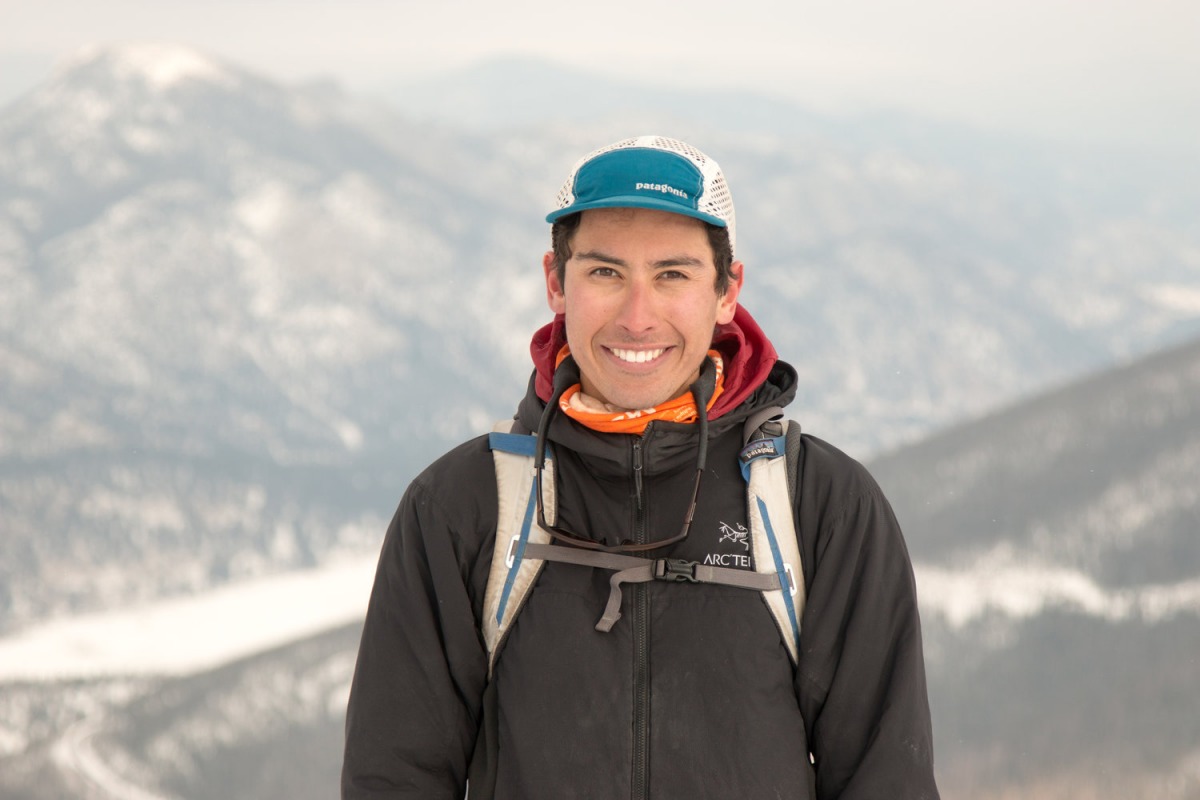
Aidan Goldie is a Vail-based backcountry skier and photographer. When he is not climbing and descending peaks in the American West, he is an outdoor educator, working with schools and nonprofits guiding groups through the Colorado wilderness. To check out more of his work visit his website

Aidan Goldie is a Basalt-based backcountry skier and photographer. When he is not climbing and descending peaks in the American West, he is an outdoor educator, working with schools and nonprofits guiding groups through the Colorado wilderness.

