Mt. Olympus: as much adventure as skiing
Photos by Cailen McDevitt and Hillary Landers
Over this past Memorial Day weekend, Hilary, Cailen, Louie and myself decided to go for a really long walk with skis on our backs. A 40+ mile long walk to be exact. Writing this now, I can’t tell you why we thought it was a wise idea or why we wanted to do it. That said, I am glad we endured the aching feet and back to ski off of remote Mt. Olympus in the Olympic range of Washington State.
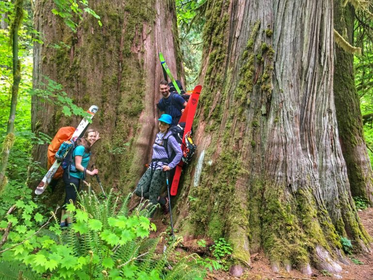
I haven’t spent that much time over on the Olympic National Park side of WA. That area is truly beautiful and different in many ways from the rest of the state, filled with towering forests, jungles of moss, nurse logs providing homes to full grown trees and neck deep-ferns hiding away forests’ inhabitants. Driving next to the ocean and arriving into the Hoh Rain Forest was the first highlight of the trip.
We started hiking from the Hoh Trailhead around 8 a.m. The first ~10 miles of the trail are relatively flat and next to a river. There are lots of day hikers who come to check out this section of the trail and admire the large trees and magic of moss. Once past the 10 mile mark, the trail starts to climb up. We made it about three miles up the steeper bit and made camp for the night.
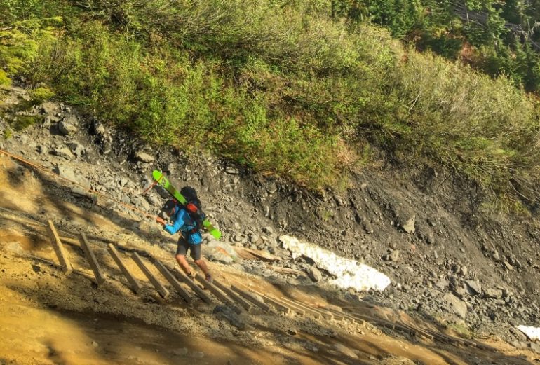
In the morning we slept through our alarm and didn’t get out of camp until 6 a.m. We stashed our heavy gear in the forest near our camp spot and headed up to Glacier Basin. We were glad to not have our heavy camping gear with us, as the trail steepened significantly. A part of the trail, about a mile below Glacier Basin, has a big wash out. We had to climb down an exciting, long rope-ladder combo to get through the washed out zone. Again, we were thankful to have less weight on our backs and have daylight for this. We did this section one at a time, and would recommend the same approach to others.
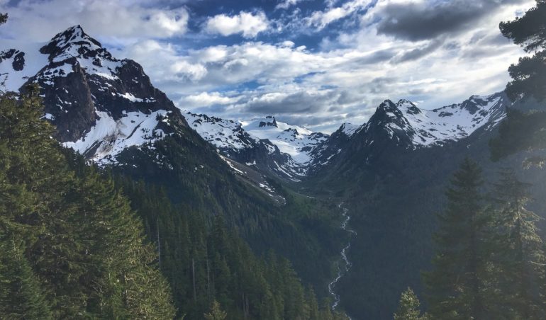
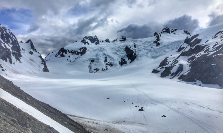
As we got to the end of the trail above Glacier Meadows, we saw less snow than expected. We had to walk down some scree to access the bottom of Blue glacier. The glacier wasn’t too broken up yet, but it was starting to look like it was melting away fast. The views from the ridge overlooking Blue Glacier sure were beautiful! Blue Glacier is the largest glacier in the Olympic Mountains, with 2.6 miles long descending from the mountain’s highest peak. It opens up to a massive landscape, with rugged ridges and wide basins, still snow covered that time of year. For those willing to make the long distance, there are some amazing camping spots.
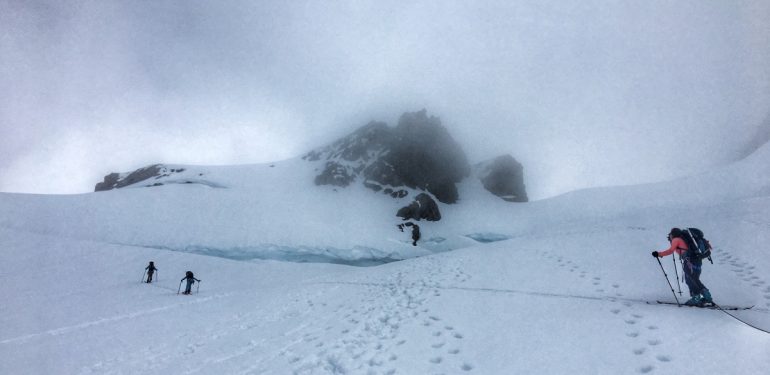
Approaching the summit, the slope to the summit is on the right slope of the photo. The route is in between two crevasses.
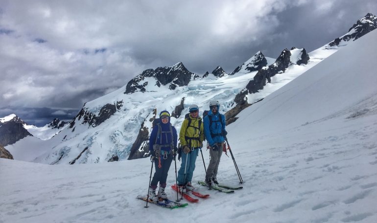
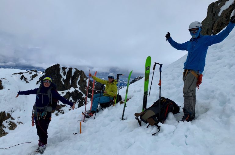
After a very long walk, it felt natural, amazing even, to click into our skis to start skinning. The snow was a bit sun-baked and the clouds were started to roll in. We quickly made it to the “ski” summit, deciding it wasn’t worth it to climb the single ~5.4 pitch to the true summit. Our journey until that point tallied ~22.2 miles and ~7k from our starting point the day before. We later heard from others coming down that the summit pitch was a traffic jam the whole day; even at 4 p.m. there were still two parties up at the top.
ROUTE BETA
Time Round Trip: 26-28 Hours (moving time)
Total Ascent: 7400 ft
Difficulty: Advanced
Top Elevation: 7969
Season: April-June
Location: Mt Olympus, West Peak, Olympic National Park, WA
GPS: 47.7998° N, 123.7066° W
Weather: Mount Olympus
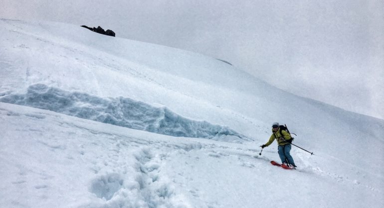
The very last 300 feet to the ski summit is quite steep (~40-45 degress) and required navigating in between two fairly large, open crevasses. Louie and I opted to ski from the top, while Cailen and Hilary opted to walk down past this section. There are only two scary turns mainly due to the steepness of the slope, narrower distance between the two crevasses and the remoteness of the place. Definitely an area to make no mistakes since the consequences are high.
The descent ended quickly and soon we were back to where we started skinning. Clouds rolled in heavier as we made our way back to Glacier Meadows. We completed the wash out section in the light, this time climbing up the ladder which proved easy to navigate, even with large packs.
Back at our camp spot from the night before, we made dinner and took some time to rest. We wanted to walk for at least a few more miles that night, trying to leave us with ~10 miles to walk the next day. As we wrapped up dinner, it was getting dark; motivations to continue were low but we pressed on for another four miles.
We found a somewhat flat camp spot pretty close to the trail, right next to a bridge (about 12 miles from the beginning) and settled in for the night around 10 p.m. We used the bridge as our bear proof food hang and quickly passed out.
We woke up around 7 a.m. and were back on our feet as fast as we could. The hike back to the car seemed to take forever, and the mostly flat trail we remembered from the way in appeared a lot less flat. The bottoms of my feet were tired; I kept rotating between putting my inserts in and then taking them out, trying to see if either was making a difference. Honestly, it just felt good to stop walking and have an activity to focus on besides feeling all the sudden body pains. Hikers around us appeared to share the sentiment, praising us for our willingness to take on a trip with such big loads. Once we were about five miles away from the end, I really was convinced that we were a bunch of insane idiots in love with suffering. I still haven’t been quite able to explain this to my grandma who was astonished by the thought of our trip.
In desperation, once I knew we only had one mile left, I jogged back to the car. I remembered I had a bag of BBQ Kettle chips stashed in the trunk. Once back in the car waiting for the rest of the crew, I proudly consumed the whole bag. After packing up at the trailhead, we stopped at a nearby resort for some beer, burgers and fries. Amazing.
Looking back at the three-day trip a day, or even a week after we did it, I may have said I’d never do it again. Now writing about it a few months later and getting excited about the upcoming winter season, I long for another epic adventure. What do they say about mountaineers being forgetful? “I’ll never do it again but I always will.”
Want to do this trip? Here are a few recommendations:
-With total distance ~44 miles, total elevation ~7k, a 3-day trip works, but 4 days would make it more enjoyable.
-Make sure to reserve camping in advance — you have to do this in person at either of the Olympic National Park ranger stations. If you do not reserve a spot, you cannot legally camp past the 10 mile mark. It seemed there was a ranger giving away “walk in” spots but from what we know those filled quickly.
-Camping about 12 miles in works well if one doesn’t want to carry heavy gear for most of the trip.
-Glacier gear is 100% necessary.
-Don’t forget you are in bear country, bring a rope to hang food or have a bear can.
-Don’t go light on food, you need that energy!
-Everything will take longer than you think, so plan ahead.
For another take on Mt. Olympus, check out this trip report from the WildSnow archives. Like what you’re reading? Subscribe to our newsletter for weekly highlights.
[mc4wp_form id=”26300″]
WildSnow Girl, Julia Dubinina, is a weekend warrior chasing snow in winter and sun in summer. A lover of long tours and steep skin tracks, she explores the Pacific Northwest and beyond. When she is not out adventuring, she is working away at her corporate desk job for a software company to make her next adventure happen.

