Stay-at-home orders have been lifting around the country in recent weeks and mountain passes are opening up. Avalanche centers have ceased their regular forecasting programs but for many of us, the ‘second season’ of spring corn skiing is full-on. Stable spring corn snow is not without its dangers, though. Enjoy this repost from American Avalanche Institute’s Sarah Carpenter on essential things to be mindful of when venturing into the late season harvest.
A checklist for smart spring skiing decisions
Spring is a challenging time for avalanche forecasting. The season brings warm weather and sunny skies, or fast moving storms with lots of snow. The challenge is to not forget about avalanches as you’re out skiing in the sunshine.
Here’s how I deal with the snowpack in the Tetons, Wyoming USA.
Red flags in a transitional snowpack
Above freezing temperatures
Cornice failure
Deep boot penetration
Cloudy skies
Wind
Rain
Intense solar gain
Avalanche activity
Above-freezing temperatures
Springtime often brings melt-freeze cycles. During the day, air temperatures rise to above freezing and the snowpack begins to melt. At night, temperatures drop below freezing and the snowpack freezes. This cycle of daytime melting and night time freezing can go on for days or even weeks.
Did it freeze last night?
If yes, how long did the temperature stay below freezing?
This offers a sense of how thick the freeze is. If temperatures dipped below freezing for 2 hours, the window for safe travel is going to be significantly smaller than if temperatures were below freezing for 10 hours. Knowing how thick the freeze might be is important, as conditions can change rapidly in the springtime.
If there was no freeze overnight, be careful. The snowpack did not regain strength, but continued to lose strength overnight. Often, significant avalanche activity occurs after the 2nd or 3rd consecutive non-freezing night. If you have multiple nights where the temperature stays above freezing, consider jumping on your road bike instead of going skiing.
Cornice failure
Beware of cornices during these melt-freeze cycles, as well as during the melt-and-no-freeze cycles. This is often when cornices fall on slopes. These can seriously injure a person, and/or trigger an avalanche.
Deep boot penetration — thickness of freeze layer
During the day, track the thickness of the freeze layer as you travel. Recognize that once that frozen “eggshell” layer has melted, the snowpack can rapidly lose strength. Try to ski slopes when the surface is just softening, instead of skiing in boot top slush.
Cloudy skies
Is the night sky clear or cloudy? Clear skies tend to deliver thicker, harder freezes, as the snow loses long wave radiation to the atmosphere. Cloudy skies limit cooling and prevent freezing.
Wind
Windy conditions often delay the softening of surface snow following a freeze. While that limits the avalanche potential, it also decreases the enjoyment of skiing perfect corn snow, while increasing the potential “slide for life” factor.
Rain
Rain at lower elevations can mean new snow up high. New snow may not bond well to a frozen spring snowpack, increasing avalanche potential.
Rain falling on snow can weaken the snowpack. Rain on new snow is especially dangerous, adding weight and decreasing the strength of a snowpack. Snowpacks that see frequent rain events may develop a drainage system for the water, increasing instability between layers.
Intense solar gain
In the spring, the safest time to ski tour is early morning when the snowpack is frozen. (Ski crampons come in handy.) Once the sun hits, strong solar radiation and/or warm temperatures can weaken the snow in a matter of minutes. Avalanche danger can change from LOW to HIGH very quickly. Be alert to changing conditions and be prepared to adjust your travel plans accordingly.
Avalanche activity
Evaluating wet loose avalanches vs. wet slab avalanches is like deciding between which cereal to buy vs. which car to buy.
Wet loose avalanches are pretty easy to evaluate and manage.
Wet slab avalanches take a greater knowledge of the snowpack structure. Stability tests are notoriously ineffective for forecasting wet slab stability.
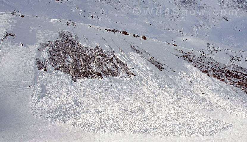
Without writing a much longer post on wet avalanches, suffice it to say that if you are seeing wet slab avalanches, it is time to really watch your terrain until the snow freezes hard or melts entirely away.
Around the Tetons it is often difficult to get all the stars to align for perfect corn skiing. Other ranges seem to be more dependable in the spring, but there are quite a few factors influencing stability and “ride-ability.”
Sarah Carpenter has spent most of her life on skis. She is the co-owner of the American Avalanche Institute and an AMGA certified ski guide. She lives in a straw bale house with her husband, Don, in Victor, ID. A year spent building a house convinced Sarah that backcountry skiing, climbing, and working in the outdoors is easier than working in construction.

