Michael Arnold
Editor’s note from Lou: We are delighted to have an AMGA/UIAGM guide reviewing this ground breaking software. If anyone has the motivation, need and experience to use Avanet, a certified guide is our man. Please know this is the first of several takes. This time we did more of an announcement and overview without in-depth critique. Mike is up in the mountains today here at Wildsnow Field HQ, using Avanet, so we look forward to his next review with real-world testing. Oh, and as with any app we’re certain Avanet will undergo many revisions and updates as it becomes widely used, so we’re not in any hurry to do a vivisection. Such will be coming in due time. Meanwhile, I’d encourage anyone with an iPhone (it’s not available for Android yet) to at least install Avanet Free and let your opinion be known.
We live in a world that constantly changes and we continually need to adapt. That applies to urban life as well as the backcountry. As a licensed mountain guide, I am in the front lines of new innovations for alpine sports. Today, AvaTech does a public launch of their Avanet smartphone software, a full package with everything from trip planning to avalanche data management.
No single person can attain the amount of information that is necessary to have full confidence going into the mountains. This is where “community” can help. Sharing information is crucial to the future of safe mountain travel.
With social media these days, we can get an idea of conditions by checking the nearly infinite feed of ski porn and “spray,” but the hard information you get from that is limited and not ideal for decision making. We need something more scientific and concrete. This is where Avatech and their Avanet app come into play.
Avatech is a new company that believes sharing information is essential to backcountry snow safety. They’ve been developing software and hardware that has the potential to be a game changer in the world of ski touring (as well as professional snow safety work).
Last year Avatech’s app, Avanet, was only available to snow safety professionals. That changes now. Avatech is launching what they’re calling the “first global crowdsource for mountain safety information.” Translation: anyone, anywhere in the world, who enjoys playing in the snowy mountains and wants to be part of a community can be a part of Avanet, share information, and thus contribute.
The Avanet app is available in three levels:
Avanet Free — Basic observation sharing, global topo and aerial maps, route tracking (recreational).
Avanet Tour ($5.00/month) — More advanced obs (observations), route planning & tracking, global maps, dynamic terrain analysis tools (recreational).
Avanet Pro ($10.00/month) — For ski patrol, guides, forecasters, avalanche educators and includes professional grade observations, professional route planning, the most comprehensive one stop shot for aerial and topo maps, and robust data sharing architecture for the pro community.
SP1, SP2 — For ski patrols, guides, forecasters and avalanche educators. This is a probe-like device that takes 5000 readings per action and develops a profile of the snow structure without digging a snowpit.
Avanet features:
Before heading out into the field, you can change your base maps and store on your device, so you’ll have all your planning data when you have no wifi or mobile connectivity.
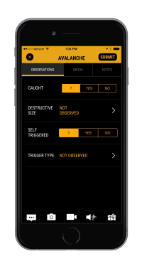
The crowd sourced obs allow you to follow users in your area and their information can help you make better decisions. These shared resources can range from weather observations, snow structure, avalanche obs and basic notes from a tour. The feature also allows you to share tour plans in different Avanet groups. If it’s your secret stash you can share privately, or go public with crucial data that can help the community, such as snow and avalanche obs.
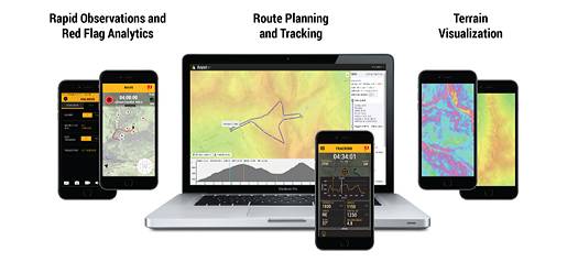
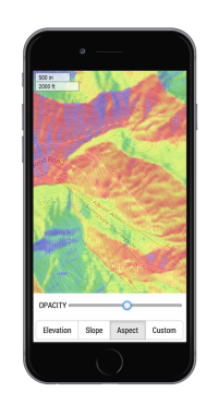
We all (hopefully) engage in systematic planning before any tour that’s more than the most basic up-and-back in heavily used terrain. Now with Avanet, the whole planning process is easier. When I was training for my guide certification, I used many different web sources for my tour plans. Now, it’s an all in one tool to increase efficiency and safety. Avanet allows you to do tour plans with all the essentials: Ascent Rate Scale, Bearings, Slope Angle, Aspect and Base Maps around the world. All the planning and prep you do at home on your desktop can be immediately uploaded to your phone via a standard GPX file. The idea is you stay in one app for virtually everything.
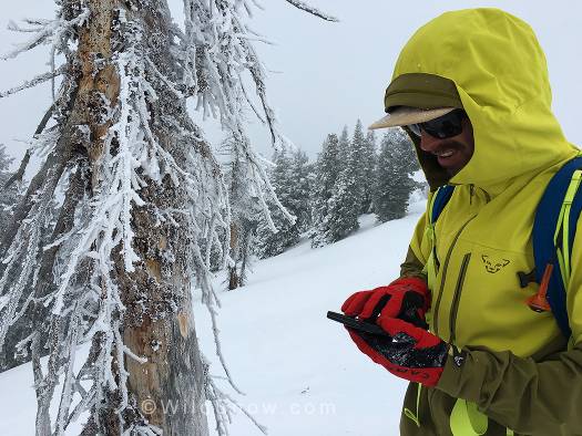
When I received the Avanet app I was immediately impressed. Comparing it to previous apps in the same field, such as Guides Pace, Gaia, iPiGenie (France), I first noticed how intuitive the app was. With my prior knowledge of map reading and tour planning, it quickly became second nature. But don’t think this is too complex, Avatech had every level of outdoor enthusiasts on their mind when developing the app. I found it totally presentable for a backcountry beginner.
Each level of Avanet has the basic navigation, mapping tools and observations. The immediate ability to share observations from the field will be invaluable to the community. As I hop on the road this winter, I look forward to using this resource no matter where I am in the mountainous regions of the world.
Avanet is currently available for iPhones (via iTunes or from the Avatech website) and on the web. Hopefully future versions will come for Android and other platforms (which at this point is our only solid criticism, though I’m sure we’ll see many versions of Avanet as inevitable bugs and improvements arise).
(WildSnow guest blogger Mike Arnold is an IFMGA mountain guide who works for Aspen Expeditions and is co-founder of Vetta Mountain Guides. When he’s not sleeping in his Sprinter van or some hut above Chamonix, he lives in the Roaring Fork Valley of Colorado.)
Beyond our regular guest bloggers who have their own profiles, some of our one-timers end up being categorized under this generic profile. Once they do a few posts, we build a category. In any case, we sure appreciate ALL the WildSnow guest bloggers!


