I didn’t get a cellphone until I went to college, and had a simple “dumb” phone for years after that (which worked out pretty well, as I enjoyed a hardened waterproof phone that survived major abuse). A few months ago I decided to make the leap into the 21st century and upgrade to a smartphone.
I ended up with a Samsung Galaxy S4, attracted by the big screen and the high-megapixel camera. I immediately started thinking about bringing my “phone” on summer adventures and seeing what things I could use it for. I’ve been investigating a variety of apps that are useful for skiing and climbing. Here are a few things I’ve been using the phone for, and some apps that I’ve found useful.
Backcountry Navigation
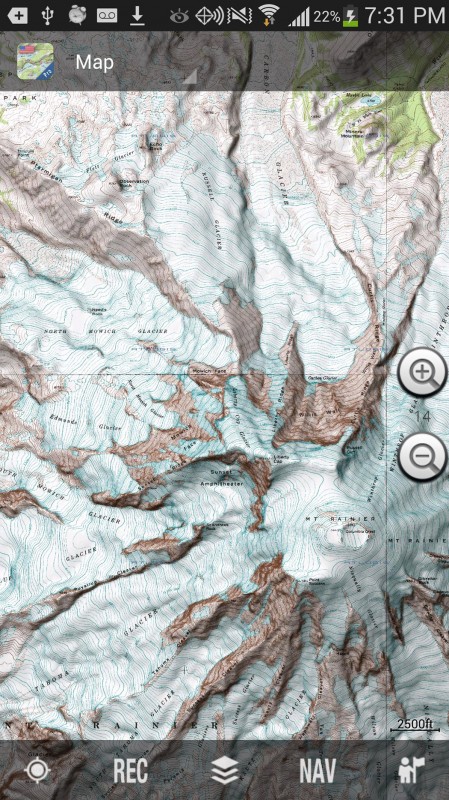
Of course besides a camera, the obvious use for a smartphone in the backcountry is as a GPS (provided your phone has a true satellite GPS built in, which most do, but not all). I decided to try out “US Topo Maps”, the first app that showed up on a search for “topo maps”. At first I tried the free version, but it doesn’t allow you to download maps to the device. I ended up with paid version. I haven’t used the app much, mostly just to make sure I didn’t get lost on the approach on trips to Mt. Adams and Mt. Rainier. Compared to my 7+ year old standalone Garmin GPS, the S4 works beautifully. It is liberating to be able to load maps onto the device without a computer, and having a giant screen is incredible. I can imagine some problems with using a touch-based phone during colder winter months, but I’ll cross that bridge when I come to it. The one issue I have is that the app doesn’t allow you to zoom past a certain level. You can zoom in close, but when you “let go”, it snaps back to a fairly zoomed out level. I’m told this is an issue with a lot of smartphone mapping/GPS apps — very annoying and mystifying as to why.

The basic interface for USA topo. It's fairly simple, and easy to use. It has a large variety of maps as well, including some nice ones for Washington.
Finding mountains!
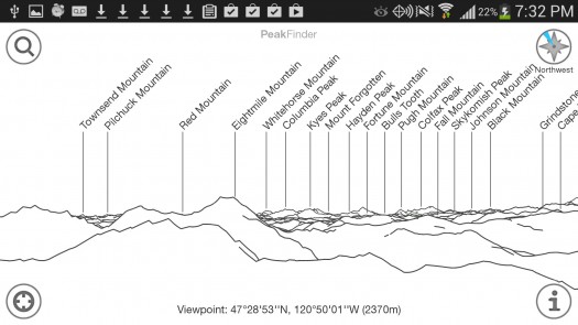
One of the reasons I decided to get a smart phone was my jealousy of friends who have an app called PeakFinder. It’s simple, and fairly impractical, but at the same time, fantastically awesome. PeakFinder generates a line-drawing skyline of the mountains around you, and labels them. Its ability to generate accurate profiles is, as far as I can tell, pure magic. For years I’ve gone on trips, seen a beautiful mountain in the distance, and spent hours pouring over Google Earth trying to figure out it’s name, usually without success. It is superb to be able to pull out a gadget and have it tell you right away. If you haven’t tried it, prepare to be amazed.
Route beta
Another great use I’ve found for the expensive gadget, especially during summer rock climbing, is as a guidebook. It’s a major pain to carry a a paper book on a climb, and even copied pages or internet printouts are bulky and easily damaged. I started out simply taking pictures of guidebook pages, and saving pictures from the internet. However, I knew there must be a better way.
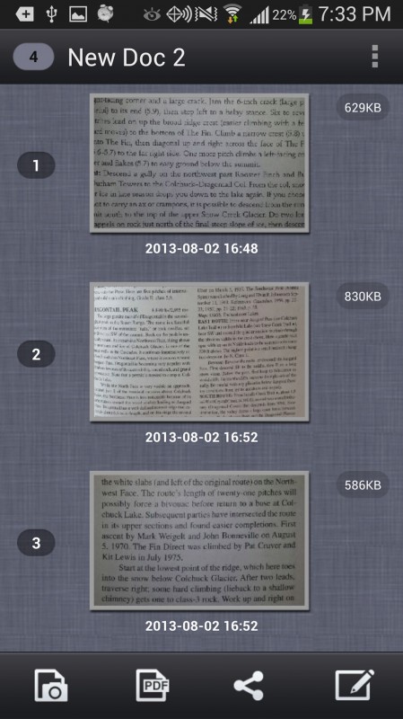
I’ve started using one of the many “scanner” apps, CamScanner, to scan guidebook pages. It’s simply a camera that’s optimized for taking pictures of text, and includes some tools to straighten and brighten the resulting image. It’ll also store them all in one PDF, so they are easy to organize and find.
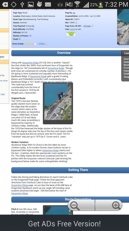
Another helpful one is a webpage downloader, such as OffLine Browser. It downloads webpages, such as trip reports and summit post pages, along with the links (you can choose how many) and photos. It’s great to be able to browse a page of beta, complete with enlargeable photos, as if it was online. It works much better than trying to copy and paste text and photos, which can be confusing.

A summit post page viewed in the offline browser app. It's almost like you are online! The only hassle is the small ads that appear on the bottom of the screen.
Weather
Another excellent use for the data-enabled phone is weather checking, mostly before heading out. I usually go to noaa.gov for weather info, and dig deep into their extensive data, mostly their “forecast discussion” and the “forecast weather table interface.” I haven’t found an app yet that even comes close to offering as much information. Even the mobile version of the NOAA page seems extremely paired down. It seems the best solution is to simply browse to the standard web version of their site.
What apps do you WildSnowers find useful for skiing and climbing? Anyone have a good suggestion for a powerful weather app?
Louie Dawson earned his Bachelor Degree in Industrial Design from Western Washington University in 2014. When he’s not skiing Mount Baker or somewhere equally as snowy, he’s thinking about new products to make ski mountaineering more fun and safe.


